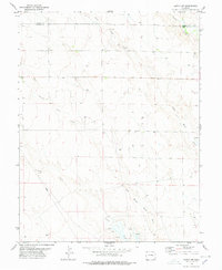
1978 Map of Kutch SW
USGS Topo · Published 1978About this map
Elbert Co Lincoln Co marks the boundary across this high plains landscape during the late 1970s, where drainage patterns define the local geography. The area is dominated by the winding path of Little Horse Creek in the north and the complex branching of Steels Fork to the south. This terrain is largely defined by its water sources, including several named Springs and an individual Spring near the eastern edge.
Find a feature on this map
10 named features on this map. Tap any name to fly to it.
Don’t see what you’re looking for? This feature index may not catch every label — zoom into the map to look around manually.
Map Details
Editions of this 1978 Kutch SW Map
This is the sole edition of this map. No revisions or reprints were ever made.
Other maps of this area

1889 · Sanborn
USGS Topo · 1:125,000

1891 · Sanborn
USGS Topo · 1:125,000

1893 · Sanborn
USGS Topo · 1:125,000

1893 · Big Springs
USGS Topo · 1:125,000

1954 · Lamar
USGS Topo · 1:250,000

1954 · Pueblo
USGS Topo · 1:250,000

1957 · Pueblo
USGS Topo · 1:250,000

1958 · Pueblo
USGS Topo · 1:250,000

1958 · Lamar
USGS Topo · 1:250,000

1962 · Pueblo
USGS Topo · 1:250,000