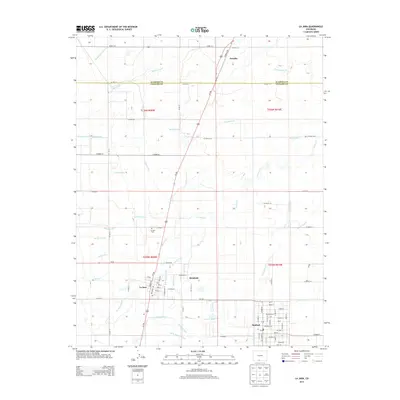
2013 Map of La Jara
USGS Topo · Published 2013About this map
The agricultural landscape of the San Luis Valley is defined by a dense network of water management features surrounding La Jara and Sanford. This 2013 survey reveals how the Alamosa River and La Jara Cr are harnessed through an intricate system of laterals and ditches, including the Empire Canal, San Luis Ditch, and Richfield Canal. These waterways dictate the settlement patterns and field boundaries throughout Conejos and Alamosa counties. In the heart of the valley, the town of La Jara is shown with its grid of streets such as Broadway Ave and Spruce St, while the nearby La Jara Cem and the smaller community of Richfield provide specific points of interest for genealogists tracing local families. The map also captures the path of Us-285 as it cuts north through Estrella, illustrating the modern transit corridor that parallels older irrigation routes like the Alamosa Farm Lateral.
Find a feature on this map
75 named features on this map. Tap any name to fly to it.
Don’t see what you’re looking for? This feature index may not catch every label — zoom into the map to look around manually.
Map Details
Editions of this 2013 La Jara Map
This is the sole edition of this map. No revisions or reprints were ever made.
Other maps of this area

1922 · Conejos
USGS Topo · 1:125,000

1945 · Durango
USGS Topo · 1:250,000

1953 · Durango
USGS Topo · 1:250,000

1954 · Durango
USGS Topo · 1:250,000

1954 · Trinidad
USGS Topo · 1:250,000

1955 · Trinidad
USGS Topo · 1:250,000

1958 · Trinidad
USGS Topo · 1:250,000

1959 · Trinidad
USGS Topo · 1:250,000

1961 · Durango
USGS Topo · 1:250,000

1963 · Durango
USGS Topo · 1:250,000