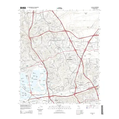
2015 Map of La Jolla
USGS Topo · Published 2015About this map
Old Town San Diego anchors the southern portion of this landscape, situated just north of the San Diego River and the complex interchange networks of Mission Valley. The area is characterized by the densely populated mesas and canyons typical of the region, with Clairemont and University City serving as primary residential hubs. Along the coast, the expansive waters of Mission Bay are intricately detailed, featuring Fiesta Island, Vacation Isle, and various coves such as Ventura Cove and Bonita Cove.
Find a feature on this map
115 named features on this map. Tap any name to fly to it.
Don’t see what you’re looking for? This feature index may not catch every label — zoom into the map to look around manually.
Map Details
Editions of this 2015 La Jolla Map
This is the sole edition of this map. No revisions or reprints were ever made.
Other maps of this area

1903 · La Jolla
USGS Topo · 1:62,500

1904 · San Diego
USGS Topo · 1:62,500

1904 · Southern California Sheet No. 2
USGS Topo · 1:250,000

1930 · La Jolla
USGS Topo · 1:62,500

1930 · San Diego
USGS Topo · 1:62,500

1942 · Poway Valley
USGS Topo · 1:31,680
1942 · La Mesa
USGS Topo · 1:31,680

1942 · Point Loma
USGS Topo · 1:31,680
1943 · Del Mar
USGS Topo · 1:31,680

1943 · La Jolla
USGS Topo · 1:31,680