2021 Map of La Quinta
USGS Topo · Published 2021About this map
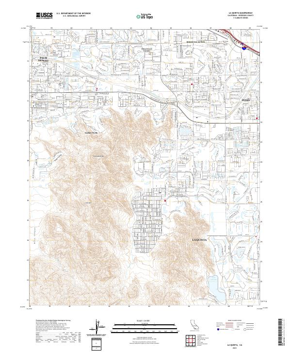
La Quinta and the surrounding Coachella Valley communities appear here during a period of dense residential expansion and established recreational infrastructure. The landscape is defined by the sharp contrast between the irrigated greenery of golf courses and the arid heights of the Santa Rosa Mountains, including Eisenhower Mtn and Indio Mtn. Significant water management features such as the Coachella Canal and Lake Cahuilla support the valley's development, while the Whitewater River channel cuts through the northern portion of the sheet.
Find a feature on this map
33 named features on this map. Tap any name to fly to it.
Don’t see what you’re looking for? This feature index may not catch every label — zoom into the map to look around manually.
Map Details
Editions of this 2021 La Quinta Map
This is the sole edition of this map. No revisions or reprints were ever made.