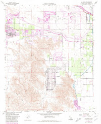
1959 Map of La Quinta
USGS Topo · Published 1980About this map
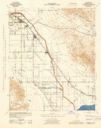
Coachella Valley irrigation and leisure define this mid-century desert landscape, where the Coachella Canal and the Coachella Valley Storm Water Channel support burgeoning desert communities. The map captures the early expansion of Palm Desert, Indian Wells, and La Quinta as they transition from isolated outposts into renowned resort destinations. These settlements are anchored by significant recreation developments like the Bermuda Dunes Country Club and El Dorado Golf Course, reflecting the post-war shift toward tourism. To the west, the steep rise of Eisenhower Mountain and Indio Mountain provides a stark contrast to the valley floor's grid of avenues, while the State Game Refuge preserves the natural character of Deep Canyon. The Southern Pacific railroad corridor near Myoma marks the traditional transport spine of the region, paralleling the seasonal flow of the Whitewater River.
Find a feature on this map
36 named features on this map. Tap any name to fly to it.
Don’t see what you’re looking for? This feature index may not catch every label — zoom into the map to look around manually.
Map Details
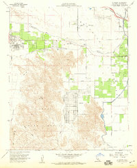
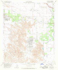
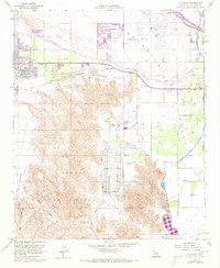
Editions of this 1959 La Quinta Map
4 editions found
Other maps of this area

1904 · Indio
USGS Topo · 1:125,000

1941 · Toro Peak
USGS Topo · 1:62,500

1941 · Coachella
USGS Topo · 1:62,500

1941 · Edom
USGS Topo · 1:62,500
1943 · Coachella
USGS Topo · 1:62,500

1944 · Toro peak
USGS Topo · 1:62,500

1944 · Edom
USGS Topo · 1:62,500

1944 · Pinyon Well
USGS Topo · 1:62,500

1947 · Santa Ana
USGS Topo · 1:250,000

1949 · Santa Ana
USGS Topo · 1:250,000