2023 Map of Lacey
USGS Topo · Published 2023About this map
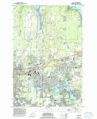
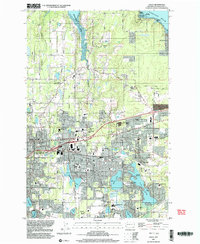
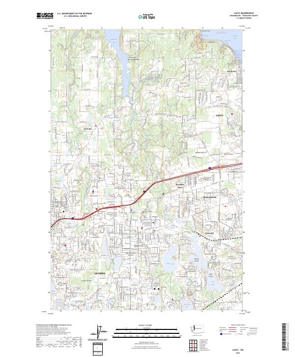
Henderson Inlet and the Nisqually Reach define the northern edge of this landscape, where the waters of Hogum Bay and Woodard Bay meet the shoreline of Thurston County. The map captures the suburban and institutional fabric of Lacey and eastern Olympia, showing the expansive grounds of Saint Martin's University alongside the historic Saint Martin's Abbey. The terrain is marked by numerous glacial kettle lakes including Hicks Lake, Pattison Lake, and Long Lake, which break up the residential developments of Tanglewilde and Hawks Prairie.
Find a feature on this map
54 named features on this map. Tap any name to fly to it.
Don’t see what you’re looking for? This feature index may not catch every label — zoom into the map to look around manually.
Map Details
Editions of this 2023 Lacey Map
This is the sole edition of this map. No revisions or reprints were ever made.