2024 Map of Lacoochee
USGS Topo · Published 2024About this map
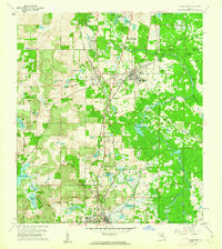
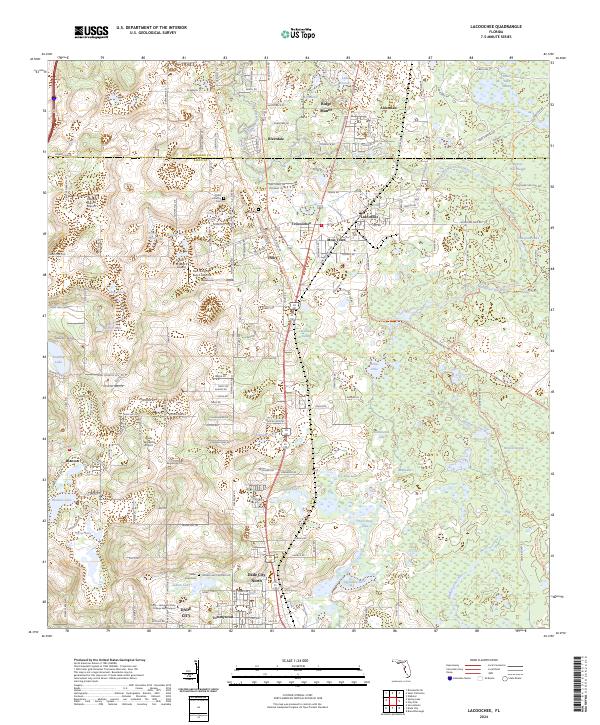
The Withlacoochee River winds through this section of Pasco County, anchoring a landscape where small settlements and agricultural airfields meet extensive wetlands like Owensboro Swamp and Wildcat Swamp. This area reflects the convergence of historical railroad corridors and modern highways, with CSX Transportation tracks passing through the communities of Trilby and Lacoochee. Local history is preserved in several small burial grounds, including Trilby Cem and the Pond Cem near Croft Pond. The geography is defined by numerous sinkhole lakes, such as Sawgrass Lake and Mirror Lake, alongside aviation landmarks like the Field of Dreams Airport and Cub Haven Airport. To the south, the map captures the outskirts of Dade City, including the neighborhood of Tommytown and the Pasco - Hernando State College East Campus.
Find a feature on this map
60 named features on this map. Tap any name to fly to it.
Don’t see what you’re looking for? This feature index may not catch every label — zoom into the map to look around manually.
Map Details
Editions of this 2024 Lacoochee Map
This is the sole edition of this map. No revisions or reprints were ever made.