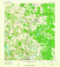
1960 Map of Lacoochee
USGS Topo · Published 1962About this map
The Withlacoochee River carves a winding path through this corner of Pasco County, anchoring a landscape defined by its wetlands and early transportation corridors. The rail junction at Trilby and the adjacent community of Trilacoochee reflect the importance of the Seaboard Air Line and Atlantic Coast Line railroads in shaping north Florida’s settlement patterns. Local life in the early 1960s is centered around small clusters like Moss Town, Riverdale, and Blanton, with essential community markers including Floyd Academy and the Spring Lake Ch.
Find a feature on this map
57 named features on this map. Tap any name to fly to it.
Don’t see what you’re looking for? This feature index may not catch every label — zoom into the map to look around manually.
Map Details
Editions of this 1960 Lacoochee Map
2 editions found
Other maps of this area

1954 · Spring Lake
USGS Topo · 1:24,000

1954 · San Antonio
USGS Topo · 1:24,000

1954 · Brooksville SE
USGS Topo · 1:24,000

1955 · Plant City
USGS Topo · 1:250,000

1958 · Plant City
USGS Topo · 1:250,000

1958 · Webster
USGS Topo · 1:24,000

1958 · Saint Catherine
USGS Topo · 1:24,000

1959 · Plant City
USGS Topo · 1:250,000

1960 · Lacoochee
USGS Topo · 1:24,000

1960 · Branchborough
USGS Topo · 1:24,000