
1954 Map of Brooksville SE
USGS Topo · Published 1955About this map
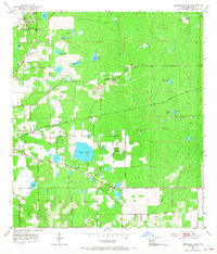
Chinsegut National Wildlife Refuge anchors the northwest corner of this mid-1950s terrain, where the elevation rises toward Chinsegut Hill. The landscape is a distinct mix of natural depressions and industrial extraction, characterized by numerous sinks and prairies like Wade Prairie and May Prairie alongside active Quarries and Mines. This era shows the local economy's heavy reliance on the earth, with the Brooksville Quarry and Camp 31 Quarry positioned near the Atlantic Coast Line railroad. Transportation and community life intersect at landmarks like the Brooksville Cem and rural houses of worship including St Louis Ch and Mt Zion Ch. The presence of an Old RR Grade and a Sluice suggests an evolving infrastructure for water management and resource transport around Bystre Lake.
Find a feature on this map
33 named features on this map. Tap any name to fly to it.
Don’t see what you’re looking for? This feature index may not catch every label — zoom into the map to look around manually.
Map Details
Editions of this 1954 Brooksville SE Map
3 editions found
Other maps of this area

1954 · Spring Lake
USGS Topo · 1:24,000

1954 · Brooksville NW
USGS Topo · 1:24,000

1954 · Nobleton
USGS Topo · 1:24,000

1954 · Brooksville
USGS Topo · 1:24,000

1954 · Masaryktown
USGS Topo · 1:24,000

1955 · Plant City
USGS Topo · 1:250,000

1958 · Plant City
USGS Topo · 1:250,000

1958 · Wahoo
USGS Topo · 1:24,000

1958 · Saint Catherine
USGS Topo · 1:24,000

1959 · Plant City
USGS Topo · 1:250,000