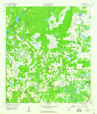
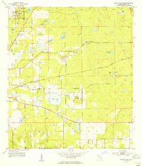
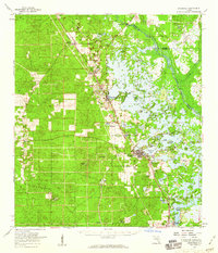
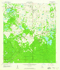
1958 Map of Wahoo
USGS Topo · Published 1960About this map
The Withlacoochee River and the vast Jumper Creek Swamp dominate this central Florida landscape, revealing a mosaic of islands, sloughs, and prairies characteristic of Sumter County in the late 1950s. The settlement of Wahoo sits at a transition point between the swampy interior and the more established rail corridors to the east. Near the edge of the sheet, the Dade Battlefield Memorial State Park marks a site of significant local and regional history, situated along the Seaboard railroad line. Deep in the wetlands, features like The Wonders, Baptizing Hole, and Soapstone Island suggest a landscape deeply integrated with local tradition and navigation. Evidence of early industry and community life appears in the scattered quarries and the Pleasant Hill Ch, while family-named landmarks like DeWitt Scrub and Hayes Sink provide valuable points of reference for genealogists tracing local land use.
Find a feature on this map
61 named features on this map. Tap any name to fly to it.
Don’t see what you’re looking for? This feature index may not catch every label — zoom into the map to look around manually.
Map Details
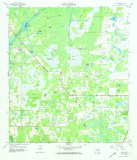
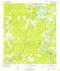
Editions of this 1958 Wahoo Map
2 editions found
Other maps of this area

1893 · Panasoffkee
USGS Topo · 1:62,500

1895 · Tsala Apopka
USGS Topo · 1:62,500

1895 · Panasoffkee
USGS Topo · 1:62,500
1954 · Nobleton
USGS Topo · 1:24,000
1954 · Inverness
USGS Topo · 1:24,000
1954 · Brooksville SE
USGS Topo · 1:24,000
1954 · Inverness
USGS Topo · 1:62,500

1955 · Plant City
USGS Topo · 1:250,000

1958 · Plant City
USGS Topo · 1:250,000
1958 · Webster
USGS Topo · 1:24,000