
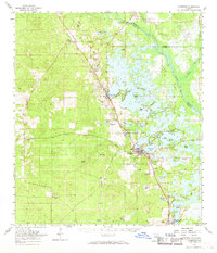
1954 Map of Inverness
USGS Topo · Published 1960About this map
Inverness serves as the focal point of this mid-century Florida landscape, situated on the western shores of the sprawling Tsala Apopka Lake chain. The map documents a complex aquatic environment where islands like Gospel Island and Pritchard Island divide the waters into smaller basins such as Henderson Lake and Cooter Lake. To the north and east, the Withlacoochee River defines the county boundaries, while the Atlantic Coast Line and Seaboard Air Line railroads provide the industrial backbone for the region, connecting smaller settlements like Hernando and Floral City.
Find a feature on this map
57 named features on this map. Tap any name to fly to it.
Don’t see what you’re looking for? This feature index may not catch every label — zoom into the map to look around manually.
Map Details
Editions of this 1954 Inverness Map
2 editions found
Other maps of this area

1892 · Dunnellon
USGS Topo · 1:62,500

1893 · Panasoffkee
USGS Topo · 1:62,500

1894 · Dunnellon
USGS Topo · 1:62,500

1895 · Tsala Apopka
USGS Topo · 1:62,500

1895 · Panasoffkee
USGS Topo · 1:62,500

1895 · Ocala
USGS Topo · 1:62,500

1954 · Lecanto
USGS Topo · 1:24,000

1954 · Homosassa
USGS Topo · 1:24,000

1954 · Holder
USGS Topo · 1:24,000

1954 · Crystal River
USGS Topo · 1:24,000