
1893 Map of Panasoffkee
USGS Topo · Published 1958About this map
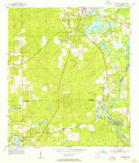
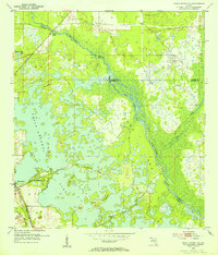
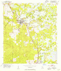
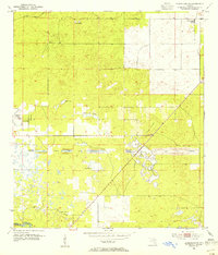
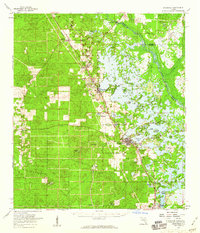
The expansive Lake Panasoffkee and the intricate wetlands of the Withlacoochee River dominate this Central Florida landscape during the late nineteenth century. This reconnaissance survey captures the region's early development, where the Florida Central and Peninsular RR connects budding settlements like Wildwood, Oxford, and Coleman. The map reveals a distinct environmental pattern of hammocks and sinks, such as Warm Spring Hammock and Hogeye Sink, interspersed between the large open waters of Tsala Apopka Lake and the dense vegetation of Gum Swamp. For the local historian, the presence of smaller communities like Orangehome, Kelvin, and Carlson along the river and rail corridors provides a look at a rail-and-water economy before twentieth-century drainage and development projects significantly altered the Florida interior.
Find a feature on this map
28 named features on this map. Tap any name to fly to it.
Don’t see what you’re looking for? This feature index may not catch every label — zoom into the map to look around manually.
Map Details
Editions of this 1893 Panasoffkee Map
This is the sole edition of this map. No revisions or reprints were ever made.
Other maps of this area

1892 · Dunnellon
USGS Topo · 1:62,500

1894 · Dunnellon
USGS Topo · 1:62,500

1895 · Tsala Apopka
USGS Topo · 1:62,500

1895 · Panasoffkee
USGS Topo · 1:62,500

1895 · Ocala
USGS Topo · 1:62,500
1954 · Nobleton
USGS Topo · 1:24,000
1954 · Tsala Apopka NE
USGS Topo · 1:24,000
1954 · Inverness
USGS Topo · 1:24,000
1954 · Dunnellon SE
USGS Topo · 1:24,000
1954 · Inverness
USGS Topo · 1:62,500