Old Maps of Sumter County, Florida
Explore 126 old maps of Sumter County, spanning from 1893 to today. These high-resolution historic maps reveal how streets, neighborhoods, landmarks, and natural features evolved over time — perfect for genealogy, metal detecting, research, and local history exploration.
What you can do with these maps:
- See how Sumter County changed over time: Compare historical maps to modern-day views to trace roads, homesites, rail lines & more.
- View detailed metadata: Each map includes creators, publishers, year, scale, and archive source.
- Overlay maps with satellite & LiDAR: Visualize the past alongside modern tools to explore terrain & human change.
- Trusted historical sources: Maps sourced from the USGS, Library of Congress, and other archives.
- Access maps your way: View online, download high-res files, or order prints for personal or research use.
Start exploring old maps of Sumter County to uncover forgotten places, hidden landmarks, and the deep history beneath your feet.
Sumter County, FL maps
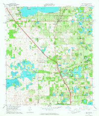
(126)- 1893 Map of Panasoffkee, 1958 Print
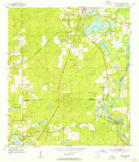
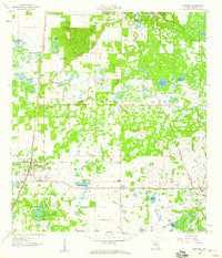
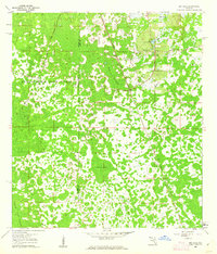
 1893 Panasoffkee1958 Print · USGSSumter County was a landscape of expansive wetlands and early rail outposts during the 1890s. Genealogists and historians can trace the early rail stops at Wildwood and Coleman or locate historic waters like Lake Panasoffkee and Warm Spring.
 - 1895 Map of Tsala Apopka
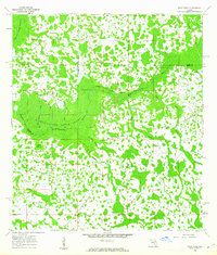
 1895 Tsala Apopka1895 Print · USGSCentral Florida's interior in the early 1890s was a landscape of citrus groves and pine hills meeting the labyrinth of the Tsala Apopka Lake system. Researchers can trace early railroad towns like Hernando and Mannfield alongside river landmarks such as Stokes Ferry and the Hamburg Mine.7 unique versions available
 - 1895 Map of Panasoffkee
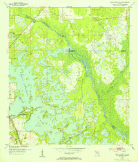
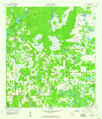
 1895 Panasoffkee1895 Print · USGSSumter County in the 1890s reveals a landscape of expansive wetlands and emerging rail towns. Genealogists and local historians can trace early settlements like Royal and Oxford or follow the route of the Florida Central and Peninsular RR.5 unique versions available
 - 1954 Map of Nobleton, 1955 Print
 1954 Nobleton1955 Print · USGSThe Citrus and Hernando county line comes alive in the mid-fifties, showing a landscape shaped by the phosphate industry and the Withlacoochee River. Genealogists can locate family landmarks like Frazier Cem and the Story Mine near Floral City.3 unique versions available
 - 1954 Map of Tsala Apopka NE, 1955 Print
 1954 Tsala Apopka NE1955 Print · USGSMid-century Citrus County is defined here by the intricate wetlands and rail lines that once fueled the local economy. Genealogists and historians can trace the foundations of Hernando and locate rural landmarks like Stokes Ferry and Twomile Prairie Lake.5 unique versions available
 - 1954 Map of Inverness, 1960 Print
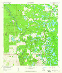
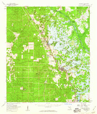 1954 Inverness1960 Print · USGSMid-century Citrus County is defined by the intricate wetlands and island communities of the lake region. Genealogists and historians can trace the paths of the Atlantic Coast Line through Hernando or locate the Dampier Cemetery and the Poor Farm Landing Field.2 unique versions available
 - 1955 Map of Plant City, 1966 Print
 1955 Plant City1966 Print · USGSMid-century Central Florida comes to life in this survey of the Nature Coast and the inland citrus and rail belt. Genealogists and historians can trace the paths of the Atlantic Coast Line, locate the Anclote Keys Lighthouse, or find old communities like Masaryktown and Lacoochee.6 unique versions available
 - 1955 Map of Orlando, 1969 Print
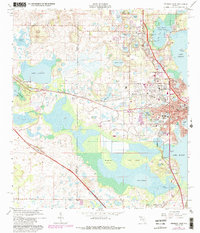
 1955 Orlando1969 Print · USGSCentral Florida was entering the space age in the mid-fifties, balancing its citrus heritage with new military and aerospace frontiers. You can trace early developments at Kennedy Space Center or locate interior settlements like Eatonville and Pine Castle.3 unique versions available
 - 1957 Map of Orlando
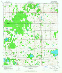
 1957 Orlando1957 Print · USGSCovers Sumter County, including Orlando, Palm Bay, and other nearby areas
 - 1958 Map of Orlando
 1958 Orlando1958 Print · USGSCentral Florida was a landscape of citrus, rail, and emerging aerospace technology during the late fifties. Researchers can trace the early footprints of Cape Canaveral and Patrick Air Force Base or locate inland citrus and rail hubs like Sanford and Lakeland.
 - 1958 Map of Plant City
 1958 Plant City1958 Print · USGSFlorida's Gulf Coast and inland ridge country are captured here in the mid-fifties, showing the region before modern sprawl. Genealogists and historians can trace rail-era towns like Richland and Trilby or locate coastal landmarks such as the Anclote Keys Lighthouse.
 - 1958 Map of Webster, 1959 Print
 1958 Webster1959 Print · USGSSumter and Hernando counties are captured here in the late fifties, showing a landscape of cypress swamps and frontier settlements. Researchers can locate family landmarks such as Mt Olive Ch, trace the Atlantic Coast Line rail route through Linden, and explore the northern reaches of the Withlacoochee State Forest.2 unique versions available
 - 1958 Map of Bushnell, 1960 Print
 1958 Bushnell1960 Print · USGSCentral Florida during the late fifties reveals a landscape defined by the crossroads of the Seaboard Air Line and the Atlantic Coast Line. Genealogists can trace family roots through Lincoln Park, Carver, and the Evergreen Cem.4 unique versions available
 - 1958 Map of Wahoo, 1960 Print
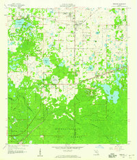
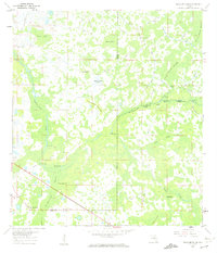
 1958 Wahoo1960 Print · USGSSumter County was a landscape of intricate wetlands and rail-line settlements during the late fifties. Researchers can trace the proximity of Wahoo to the Seaboard railroad or locate historic sites like Dade Battlefield Memorial State Park and Pleasant Hill Ch.2 unique versions available
 - 1958 Map of Saint Catherine, 1960 Print
 1958 Saint Catherine1960 Print · USGSRailroad junctions and river bottomlands meet in this late 1950s study of the Sumter and Hernando county line. Genealogists and historians can trace the rail sidings of Saint Catherine, find rural landmarks like Little Rock Ch, or locate the old Phosphate Pit and Quarry sites.3 unique versions available
 - 1959 Map of Plant City
 1959 Plant City1959 Print · USGSThe West Florida coast and inland timberlands are captured here in the late fifties, from the bend of the Gulf to the rail hubs of the interior. Trace the paths of the Atlantic Coast Line through Inverness and find landmarks like the Anclote Keys Lighthouse.
 - 1960 Map of Branchborough, 1962 Print
 1960 Branchborough1962 Print · USGSThe swampy interior of Florida at the tri-county border shows a landscape of riverine hammocks and early forest industry in the 1960s. Genealogists and historians can trace the foundations of Branchborough and locate Withlacoochee Cemetery and Port Lonesome.4 unique versions available
 - 1960 Map of Bay Lake, 1962 Print
 1960 Bay Lake1962 Print · USGSFlorida's interior wetlands and timberlands are captured here in the early sixties, centered on the Sumter and Lake County border. Genealogists and historians can trace local landmarks like Bay Lake Ch or follow the path of the Seaboard Air Line through the cypress hammocks.3 unique versions available
 - 1960 Map of Rock Ridge, 1962 Print
 1960 Rock Ridge1962 Print · USGSThe Florida swamp country at the edge of Polk and Sumter Counties comes into focus during the early sixties. Genealogists and historians can trace the foundations of the Rock Ridge community, including Little Flock Ch and numerous segments of an Old Railroad Grade.4 unique versions available
 - 1960 Map of Clay Sink, 1962 Print
 1960 Clay Sink1962 Print · USGSFlorida's swampy interior at the Hernando and Pasco county line reveals a wilderness of forestry grades and isolated settlements in the early sixties. Researchers can trace the Atlantic Coast Line and locate sites like Bevels Place, Richloam, and Sturkey.2 unique versions available
 - 1962 Map of Orlando
 1962 Orlando1962 Print · USGSCentral Florida was transformed by aerospace and citrus at the start of the sixties. Genealogists and historians can trace old community footprints from Eau Gallie to Leesburg, alongside landmarks like McCoy AFB and the winding Econlockhatchee River.
 - 1964 Map of Plant City
 1964 Plant City1964 Print · USGSThe West Florida coast and its interior rail corridors come alive in this mid-sixties survey, spanning from the gulf marshes to the agricultural heartland. Researchers can trace the routes of the Atlantic Coast Line through settlements like Bushnell, Inverness, and Plant City.
 - 1966 Map of Leesburg West
 1966 Leesburg West1966 Print · USGSMid-century Leesburg and Lake County are shown as the citrus groves and lakefronts began to welcome new residential growth. Genealogists and researchers can locate Lone Oak Cemetery, trace the Seaboard Coast Line, or find landmarks like Bugg Spring and Shiloh Ch.5 unique versions available
 - 1966 Map of Lady Lake, 1967 Print
 1966 Lady Lake1967 Print · USGSThe citrus-growing country between Lake and Marion counties comes into focus during the mid-sixties, centered on the growing community of Lady Lake. Researchers can trace local genealogy and land use through labels for Forest Hill Cem, Stanton Sch, and the Seaboard Coast Line railroad.4 unique versions available
 - 1966 Map of Oxford, 1968 Print
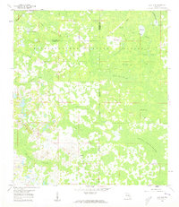
 1966 Oxford1968 Print · USGSSumter and Marion County history comes alive in the mid-1960s, showing the early footprints of Orange Blossom Hills and the rural rail corridor. Trace family roots through Royal Memorial Cem, New Jerusalem Ch, or the small settlements of Pedro and Dallas.
Showing maps 1-25 of 126
Top cities of Sumter County
- The Villages historical maps
- Wildwood historical maps
- Bushnell historical maps
- Center Hill historical maps
- Webster historical maps
- Coleman historical maps
Frequently asked questions
- What are the different types of historical maps available for Sumter County?
- What is the oldest map of Sumter County?
- Where can I purchase historical maps of Sumter County for my home or office?
- Where can I download high-res historical maps of Sumter County?
- Are there historical topographic maps available for Sumter County?
- Is there historical aerial imagery available for Sumter County?
- Where are historical maps of Sumter County sourced from?