1950s Maps of Sumter County, Florida
Explore 13 historic maps of Sumter County from the 1950s. These maps offer a rare glimpse into what life looked like during the 1950s — showing old roads, neighborhoods, homes, and landmarks that have changed or disappeared over time.
Whether you're researching your family's past, planning a metal detecting trip, or studying how Sumter County's landscape evolved across the 1950s, these high-resolution maps are a powerful tool for exploring the history of this region.
- Focus on a specific era: All maps on this page are from the 1950s, giving you a focused view of this time period.
- See what’s changed: Compare century-old streets, trails, and buildings to today's modern landscape using overlays and satellite layers.
- Research with precision: Use these maps for genealogy, historical research, land use analysis, or educational projects.
- View, download, or print: Maps are fully viewable online in high resolution, and can be downloaded or printed for your own records.
Start exploring Sumter County's history through authentic maps from the 1950s. This is your window into the past.
Sumter County, FL maps
(13)- 1954 Map of Nobleton, 1955 Print
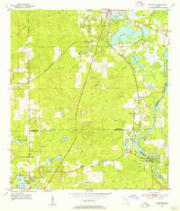 1954 Nobleton1955 Print · USGSThe Citrus and Hernando county line comes alive in the mid-fifties, showing a landscape shaped by the phosphate industry and the Withlacoochee River. Genealogists can locate family landmarks like Frazier Cem and the Story Mine near Floral City.3 unique versions available
 - 1954 Map of Tsala Apopka NE, 1955 Print
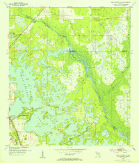 1954 Tsala Apopka NE1955 Print · USGSMid-century Citrus County is defined here by the intricate wetlands and rail lines that once fueled the local economy. Genealogists and historians can trace the foundations of Hernando and locate rural landmarks like Stokes Ferry and Twomile Prairie Lake.5 unique versions available
 - 1954 Map of Inverness, 1960 Print
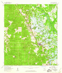 1954 Inverness1960 Print · USGSMid-century Citrus County is defined by the intricate wetlands and island communities of the lake region. Genealogists and historians can trace the paths of the Atlantic Coast Line through Hernando or locate the Dampier Cemetery and the Poor Farm Landing Field.2 unique versions available
 - 1955 Map of Plant City, 1966 Print
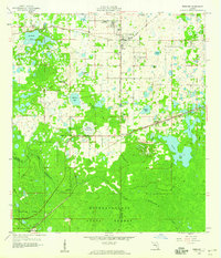
 1955 Plant City1966 Print · USGSMid-century Central Florida comes to life in this survey of the Nature Coast and the inland citrus and rail belt. Genealogists and historians can trace the paths of the Atlantic Coast Line, locate the Anclote Keys Lighthouse, or find old communities like Masaryktown and Lacoochee.6 unique versions available
 - 1955 Map of Orlando, 1969 Print
 1955 Orlando1969 Print · USGSCentral Florida was entering the space age in the mid-fifties, balancing its citrus heritage with new military and aerospace frontiers. You can trace early developments at Kennedy Space Center or locate interior settlements like Eatonville and Pine Castle.3 unique versions available
 - 1957 Map of Orlando
 1957 Orlando1957 Print · USGSCovers Sumter County, including Orlando, Palm Bay, and other nearby areas
 - 1958 Map of Orlando
 1958 Orlando1958 Print · USGSCentral Florida was a landscape of citrus, rail, and emerging aerospace technology during the late fifties. Researchers can trace the early footprints of Cape Canaveral and Patrick Air Force Base or locate inland citrus and rail hubs like Sanford and Lakeland.
 - 1958 Map of Plant City
 1958 Plant City1958 Print · USGSFlorida's Gulf Coast and inland ridge country are captured here in the mid-fifties, showing the region before modern sprawl. Genealogists and historians can trace rail-era towns like Richland and Trilby or locate coastal landmarks such as the Anclote Keys Lighthouse.
 - 1958 Map of Webster, 1959 Print
 1958 Webster1959 Print · USGSSumter and Hernando counties are captured here in the late fifties, showing a landscape of cypress swamps and frontier settlements. Researchers can locate family landmarks such as Mt Olive Ch, trace the Atlantic Coast Line rail route through Linden, and explore the northern reaches of the Withlacoochee State Forest.2 unique versions available
 - 1958 Map of Bushnell, 1960 Print
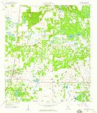 1958 Bushnell1960 Print · USGSCentral Florida during the late fifties reveals a landscape defined by the crossroads of the Seaboard Air Line and the Atlantic Coast Line. Genealogists can trace family roots through Lincoln Park, Carver, and the Evergreen Cem.4 unique versions available
 - 1958 Map of Wahoo, 1960 Print
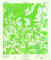 1958 Wahoo1960 Print · USGSSumter County was a landscape of intricate wetlands and rail-line settlements during the late fifties. Researchers can trace the proximity of Wahoo to the Seaboard railroad or locate historic sites like Dade Battlefield Memorial State Park and Pleasant Hill Ch.2 unique versions available
 - 1958 Map of Saint Catherine, 1960 Print
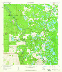 1958 Saint Catherine1960 Print · USGSRailroad junctions and river bottomlands meet in this late 1950s study of the Sumter and Hernando county line. Genealogists and historians can trace the rail sidings of Saint Catherine, find rural landmarks like Little Rock Ch, or locate the old Phosphate Pit and Quarry sites.3 unique versions available
 - 1959 Map of Plant City
 1959 Plant City1959 Print · USGSThe West Florida coast and inland timberlands are captured here in the late fifties, from the bend of the Gulf to the rail hubs of the interior. Trace the paths of the Atlantic Coast Line through Inverness and find landmarks like the Anclote Keys Lighthouse.
End of results
Showing maps 1-13 of 13
Top cities of Sumter County
- The Villages historical maps
- Wildwood historical maps
- Bushnell historical maps
- Center Hill historical maps
- Webster historical maps
- Coleman historical maps
Frequently asked questions
- What are the different types of historical maps available for Sumter County?
- What is the oldest map of Sumter County?
- Where can I purchase historical maps of Sumter County for my home or office?
- Where can I download high-res historical maps of Sumter County?
- Are there historical topographic maps available for Sumter County?
- Is there historical aerial imagery available for Sumter County?
- Where are historical maps of Sumter County sourced from?