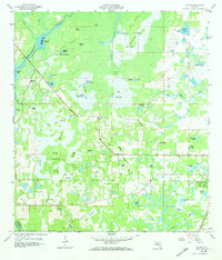
1958 Map of Wahoo
USGS Topo · Published 1973About this map
The Withlacoochee River forms the northwestern boundary of this mid-century Florida landscape, winding past Bonnet Lake and through a complex network of sloughs and hammocks. The settlement of Wahoo and the Bay Hill community anchor the interior, providing a window into the rural life of Sumter County before extensive modern development. The terrain is defined by the massive Jumper Creek Swamp and numerous named islands like Soapstone Island and Cabbage Island, which rise from the wetlands.
Find a feature on this map
67 named features on this map. Tap any name to fly to it.
Don’t see what you’re looking for? This feature index may not catch every label — zoom into the map to look around manually.
Map Details
Editions of this 1958 Wahoo Map
2 editions found

Other maps of this area

1893 · Panasoffkee
USGS Topo · 1:62,500

1895 · Tsala Apopka
USGS Topo · 1:62,500

1895 · Panasoffkee
USGS Topo · 1:62,500

1954 · Nobleton
USGS Topo · 1:24,000

1954 · Inverness
USGS Topo · 1:24,000

1954 · Brooksville SE
USGS Topo · 1:24,000

1954 · Inverness
USGS Topo · 1:62,500

1955 · Plant City
USGS Topo · 1:250,000

1958 · Plant City
USGS Topo · 1:250,000

1958 · Webster
USGS Topo · 1:24,000