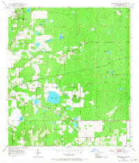
1954 Map of Brooksville SE
USGS Topo · Published 1968About this map
The Chinsegut National Wildlife Refuge and the surrounding Hernando County landscape are defined here by a distinct karst topography of sinks, prairies, and high ground. Centered around Chinsegut Hill, the terrain rises toward significant elevations like Tucker Hill—complete with its Lookout Tower—and Munden Hill. These highlands are separated by seasonal water features and semi-permanent basins such as Bystre Lake, Wade Prairie, and Blue Sink.
Find a feature on this map
35 named features on this map. Tap any name to fly to it.
Don’t see what you’re looking for? This feature index may not catch every label — zoom into the map to look around manually.
Map Details
Editions of this 1954 Brooksville SE Map
3 editions found
Other maps of this area

1954 · Spring Lake
USGS Topo · 1:24,000

1954 · Brooksville NW
USGS Topo · 1:24,000

1954 · Nobleton
USGS Topo · 1:24,000

1954 · Brooksville
USGS Topo · 1:24,000

1954 · Masaryktown
USGS Topo · 1:24,000

1954 · Brooksville SE
USGS Topo · 1:24,000

1955 · Plant City
USGS Topo · 1:250,000

1958 · Plant City
USGS Topo · 1:250,000

1958 · Wahoo
USGS Topo · 1:24,000

1958 · Saint Catherine
USGS Topo · 1:24,000