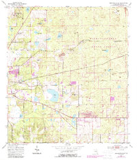
1954 Map of Brooksville SE
USGS Topo · Published 1988About this map
Brooksville and its eastern environs are defined by a complex landscape of karst topography and early industrial extraction in the mid-1950s. The terrain is a mixture of prominent rises like Chinsegut Hill and numerous depressions that form ephemeral or permanent water bodies such as Bystre Lake and Harris Pond. The presence of the Withlacoochee State Forest covers the eastern portion of the sheet, where a Lookout Tower sits atop Tucker Hill.
Find a feature on this map
40 named features on this map. Tap any name to fly to it.
Don’t see what you’re looking for? This feature index may not catch every label — zoom into the map to look around manually.
Map Details
Editions of this 1954 Brooksville SE Map
3 editions found
Other maps of this area

1954 · Spring Lake
USGS Topo · 1:24,000

1954 · Brooksville NW
USGS Topo · 1:24,000

1954 · Nobleton
USGS Topo · 1:24,000

1954 · Brooksville
USGS Topo · 1:24,000

1954 · Masaryktown
USGS Topo · 1:24,000

1954 · Brooksville SE
USGS Topo · 1:24,000

1955 · Plant City
USGS Topo · 1:250,000

1958 · Plant City
USGS Topo · 1:250,000

1958 · Wahoo
USGS Topo · 1:24,000

1958 · Saint Catherine
USGS Topo · 1:24,000