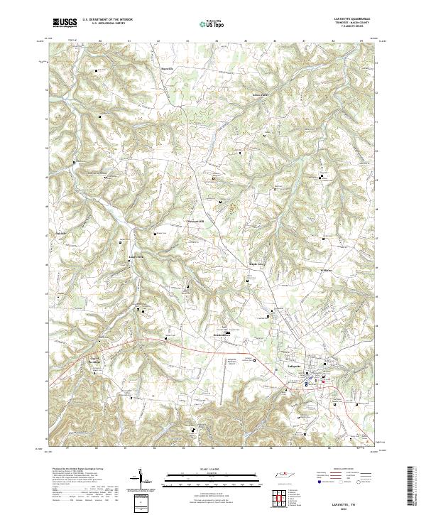
2022 Map of Lafayette
USGS Topo · Published 2022About this map
The town of Lafayette serves as the focal point of this North-Central Tennessee landscape, where the modern infrastructure of the Lafayette Municipal Airport and the Macon County Justice Center meets a deeply rooted rural history. The terrain is defined by a dense network of ridges and hollows, including the notable Gap of the Ridge and Peddlers Ridge. Waterways such as the Middle Fork Goose Cr and Puncheon Cr carve through the limestone-influenced topography, creating the distinct pockets that define small communities like Haysville, Brattontown, and Maple Grove.
Find a feature on this map
119 named features on this map. Tap any name to fly to it.
Don’t see what you’re looking for? This feature index may not catch every label — zoom into the map to look around manually.
Map Details
Editions of this 2022 Lafayette Map
This is the sole edition of this map. No revisions or reprints were ever made.
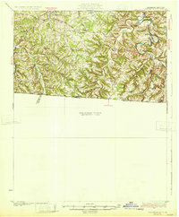
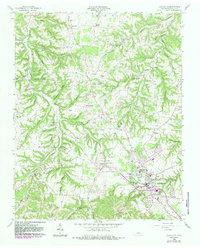
Historical Maps of Maple Grove Through Time
3 maps found