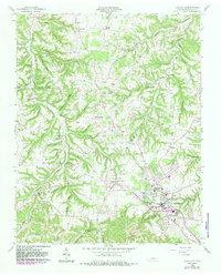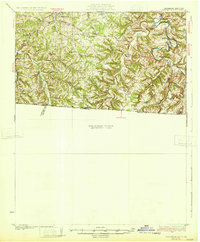
1931 Map of Lafayette
USGS Topo · Published 1931About this map
Scottsville serves as the primary hub of activity in this 1928 survey of the Kentucky-Tennessee borderlands. The landscape is defined by the winding course of the Barren River and its deeply incised tributaries like Trammel and Puncheon Creek. This area exhibits a high density of rural community markers, with dozens of family-named schools and churches such as Macedonia Ch, Dooly Sch, and New Salem Ch distributed across the hollows. The Louisville and Nashville railroad cuts through the northwestern corner, providing a vital link to the outside world for the farming communities around Holland and Amos. Geological features like The Sink and the Natural Bridge highlight the unique karst topography of the region, while landmarks like Horse Shoe Bend and Newsharp Bend illustrate the dramatic meanders of the river system before modern development altered the local water table.
Find a feature on this map
63 named features on this map. Tap any name to fly to it.
Don’t see what you’re looking for? This feature index may not catch every label — zoom into the map to look around manually.
Map Details
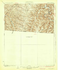
Editions of this 1931 Lafayette Map
2 editions found
Historical Maps of Scottsville Through Time
7 maps found