
1954 Map of Austin
USGS Topo · Published 1955About this map
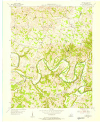
Barren River meanders sharply through the heart of this mid-century landscape, defining the winding boundary between Allen and Barren counties. This 1950s survey documents a rural Kentucky community centered around the settlement of Austin, where the Austin-Tracy High Sch and its predecessor, Old Austin-Tracy High Sch, stand as local landmarks. The area is densely patterned with country schools and churches, including Cedar Cross Ch, Hopewell Ch, and Pleasant Home Ch, reflecting a deeply rooted social structure before the major school consolidations of the late 20th century.
Find a feature on this map
36 named features on this map. Tap any name to fly to it.
Don’t see what you’re looking for? This feature index may not catch every label — zoom into the map to look around manually.
Map Details
Editions of this 1954 Austin Map
This is the sole edition of this map. No revisions or reprints were ever made.
Other maps of this area

1926 · Scottsville
USGS Topo · 1:62,500

1931 · Lafayette
USGS Topo · 1:62,500

1931 · Red Boiling Springs
USGS Topo · 1:62,500

1953 · Tracy
USGS Topo · 1:24,000

1953 · Glasgow South
USGS Topo · 1:24,000

1954 · Fountain Run
USGS Topo · 1:24,000

1954 · Petroleum
USGS Topo · 1:24,000

1954 · Scottsville
USGS Topo · 1:24,000
1954 · Meador
USGS Topo · 1:24,000

1954 · Holland
USGS Topo · 1:24,000