
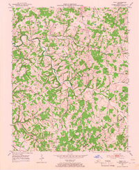
1953 Map of Tracy
USGS Topo · Published 1954About this map
Peter Creek and its many winding tributaries like Caney Fork and Dry Fork carve through the landscape of the Barren and Monroe county borderlands in the early 1950s. This agricultural region is defined by a dense network of country schools and family-centered landmarks. Small rural hubs such as Cooktown, Etoile, and Tracy serve as focal points for the surrounding farmsteads. The map reveals a high concentration of small cemeteries and local congregations, including Pleasant Hill Ch, Kirby Grove Ch, and Pleasant Point Ch. A notable industrial marker is the Gas Well located in the southern portion of the sheet near Hunt Creek, indicating early resource extraction in an otherwise pastoral setting. Genealogists will find significant value in the numerous family-named burial grounds like Mosby Cem, Chambers Cem, and Thompson Cem that dot the hillsides.
Find a feature on this map
36 named features on this map. Tap any name to fly to it.
Don’t see what you’re looking for? This feature index may not catch every label — zoom into the map to look around manually.
Map Details
Editions of this 1953 Tracy Map
2 editions found
Other maps of this area

1926 · Scottsville
USGS Topo · 1:62,500

1931 · Lafayette
USGS Topo · 1:62,500

1931 · Red Boiling Springs
USGS Topo · 1:62,500

1953 · Temple Hill
USGS Topo · 1:24,000

1953 · Glasgow South
USGS Topo · 1:24,000

1953 · Freedom
USGS Topo · 1:24,000

1954 · Austin
USGS Topo · 1:24,000

1954 · Fountain Run
USGS Topo · 1:24,000

1954 · Gamaliel
USGS Topo · 1:24,000

1954 · Holland
USGS Topo · 1:24,000