Old Maps of Barren County, Kentucky
Explore 149 old maps of Barren County, spanning from 1922 to today. These high-resolution historic maps reveal how streets, neighborhoods, landmarks, and natural features evolved over time — perfect for genealogy, metal detecting, research, and local history exploration.
What you can do with these maps:
- See how Barren County changed over time: Compare historical maps to modern-day views to trace roads, homesites, rail lines & more.
- View detailed metadata: Each map includes creators, publishers, year, scale, and archive source.
- Overlay maps with satellite & LiDAR: Visualize the past alongside modern tools to explore terrain & human change.
- Trusted historical sources: Maps sourced from the USGS, Library of Congress, and other archives.
- Access maps your way: View online, download high-res files, or order prints for personal or research use.
Start exploring old maps of Barren County to uncover forgotten places, hidden landmarks, and the deep history beneath your feet.
Barren County, KY maps
(149)- 1922 Map of Mammoth Cave, 1957 Print
 1922 Mammoth Cave1957 Print · USGSThe Green River valley and the Kentucky karst country are captured here in the early 1920s, before the full development of the national park. Researchers can trace family-named landmarks and long-established crossings like Fishtrap Ferry, Good Spring Church, and the world-renowned Mammoth Cave.7 unique versions available
 - 1923 Map of Mammoth Cave
 1923 Mammoth Cave1923 Print · USGSThe subterranean wonders of Edmonson County are mapped in the early 1920s alongside the river ferries and rail towns of the Kentucky karst. Family historians can trace ancestral roots through dozens of local landmarks like Good Spring Church, Ollie School, and Houchins Ferry.6 unique versions available
 - 1926 Map of Scottsville
 1926 Scottsville1926 Print · USGSThe Barren River valley in the mid-twenties was a landscape of ferries and fords connecting isolated rural schools and churches. Researchers can trace ancestral locations like Scottsville, find the Rocky Hill Game PO, or locate the Rough and Ready School.
 - 1931 Map of Red Boiling Springs
 1931 Red Boiling Springs1931 Print · USGSCrossing the state line during the late twenties, this survey captures a landscape of ridge-top schools and creek-side settlements. Genealogists can trace family footprints through numerous rural landmarks like Sadlers Chapel, Akersville, and Hermitage Springs PO.3 unique versions available
 - 1935 Map of Horse Cave
 1935 Horse Cave1935 Print · USGSHart and Barren counties in the mid-1930s reveal a landscape shaped by cave tourism and rural education. Genealogists can trace family footprints through dozens of local landmarks like Ragman Seminary, Bunnells Crossing, and New Hope Ch.
 - 1938 Map of Horse Cave
 1938 Horse Cave1938 Print · USGSKentucky's cave country thrives in the late 1930s as a hub of early auto tourism and rail commerce. Genealogists can trace family roots through dozen of rural landmarks like Walton Academy, Mammoth Onyx Cave, and the Big Meadow Ch.2 unique versions available
 - 1953 Map of Sulphur Well, 1954 Print
 1953 Sulphur Well1954 Print · USGSMetcalfe County is shown here in the early fifties, characterized by its river-valley farming communities and rural schoolhouse network. Researchers can trace family history through sites like Seven Springs Cem, Sugar Plant Sch, and the settlement at Sulphur Well.2 unique versions available
 - 1953 Map of Tracy, 1954 Print
 1953 Tracy1954 Print · USGSThe rural borderlands of Barren and Monroe counties come alive in the early 1950s, showing a landscape of family farms and creek-bottom communities. Researchers can locate local landmarks like Cooktown, Tracy, and numerous schools including Antioch Sch.2 unique versions available
 - 1953 Map of Sulphur Lick, 1954 Print
 1953 Sulphur Lick1954 Print · USGSMonroe County and the hills along the Barren River are captured here in the early fifties, before modern consolidation changed the local landscape. Genealogists and historians can trace family roots through numerous small landmarks like Miller Cave, Skaggs Creek Ch, and the Wade Cem.3 unique versions available
 - 1953 Map of Temple Hill, 1954 Print
 1953 Temple Hill1954 Print · USGSBarren County's rural communities are captured here in the early fifties, showing a landscape defined by small-scale farming and local parishes. Researchers can trace family history through sites like Forest Seminary Sch, Eighty Eight, and the Peden Cem.2 unique versions available
 - 1953 Map of Glasgow South, 1954 Print
 1953 Glasgow South1954 Print · USGSBarren County south of Glasgow comes alive in the early fifties, showing a rural landscape of family-named schools and small farming hamlets. Trace local roots through Bartow Cem, the old Cedar Grove Sch, or the streets of Pritchardsville.
 - 1953 Map of Freedom, 1954 Print
 1953 Freedom1954 Print · USGSThe Barren and Monroe County line in the early fifties shows a landscape of rural hamlets and small schoolhouses. Trace family roots at Words Chapel, Freedom, and rural sites like Boyd Sch or the Biggers Cem.2 unique versions available
 - 1953 Map of Summer Shade, 1955 Print
 1953 Summer Shade1955 Print · USGSThe rural uplands of south-central Kentucky are shown here in the mid-fifties as a network of ridge-top settlements and creek-side farms. Researchers can trace ancestral locations like Randolph, Summer Shade, and Goodluck, alongside remote landmarks like Harvey Cave and Hickory College Ch.
 - 1953 Map of Center, 1955 Print
 1953 Center1955 Print · USGSHart and Metcalfe counties come alive in the mid-fifties as a landscape of remote farmsteads and river bends. Genealogists can locate family landmarks like Allens Grove Ch, Bastin Cem, and the small settlement of Whickerville.
 - 1954 Map of Evansville
 1954 Evansville1954 Print · USGSThe Ohio River borderlands between Indiana and Kentucky appear here during a period of robust industrial and military growth. Genealogists and researchers can trace the rail corridors of the Illinois Central and find landmarks like US Lock and Dam No 48 or Camp Breckinridge.
 - 1954 Map of Park, 1955 Print
 1954 Park1955 Print · USGSSouth-central Kentucky during the mid-fifties reveals a landscape of limestone sinkholes and prominent knobs at the junction of two major early highways. Trace family roots at Bear Wallow, find the Oak Ridge Sch, or locate numerous early Oil Wells around Rex.2 unique versions available
 - 1954 Map of Horse Cave, 1955 Print
 1954 Horse Cave1955 Print · USGSMid-century Kentucky karst country is on full display here, capturing the area between Horse Cave and Cave City at a peak of local rail and road travel. Genealogists and historians can locate numerous rural landmarks like Our Lady of the Caves Ch, Northtown, and the winding Green River loops.2 unique versions available
 - 1954 Map of Austin, 1955 Print
 1954 Austin1955 Print · USGSThe Barren River hills of rural Kentucky come to life in the mid-1950s, showing a landscape defined by sharp river bends and scattered ridge-top farms. Genealogists can locate old family landmarks like Browns Ford, Pleasant Home Ch, and the Old Austin-Tracy High Sch before modern changes transformed the region.
 - 1954 Map of Fountain Run, 1955 Print
 1954 Fountain Run1955 Print · USGSSouthern Kentucky and northern Tennessee meet along the Barren River in the mid-fifties, showing a rural landscape of ridges and hollows. Genealogists can trace family roots through numerous local landmarks like Fountain Run Sch, Old Rocky Hill Ch, and Akersville.2 unique versions available
 - 1954 Map of Park City, 1955 Print
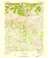 1954 Park City1955 Print · USGSThe limestone country of Barren and Edmonson counties is captured here in the mid-1950s. Researchers can trace the legacy of travel and tourism through Diamond Caverns, the Dixie Highway, and rural stops like Bon Ayr.2 unique versions available
 - 1954 Map of Meador, 1955 Print
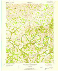 1954 Meador1955 Print · USGSThe Barren River winds through this rural Kentucky landscape during the mid-1950s, marking the convergence of Warren, Allen, and Barren counties. Local historians can trace family roots through numerous country landmarks like Mt Union Ch, Berry Store, and river crossings at Martinsville Ford.
 - 1954 Map of Glasgow North, 1956 Print
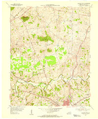 1954 Glasgow North1956 Print · USGSBarren County, Kentucky, thrives in the mid-fifties as a hub of rural commerce and community life anchored by the city of Glasgow. Genealogists and historians can trace family locations through numerous landmarks like Browders Chapel, Sinking Spring Sch, and the Oil Wells of Oil City.
 - 1954 Map of Smiths Grove, 1956 Print
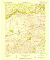 1954 Smiths Grove1956 Print · USGSThe Warren County countryside south of the Green River corridor thrived as a mid-century transit hub during the 1950s. Genealogists and historians can trace the legacy of families near Smiths Grove through landmarks like Kinser Cem, Cole Sch, and the Louisville and Nashville rail line.
 - 1954 Map of Hiseville, 1956 Print
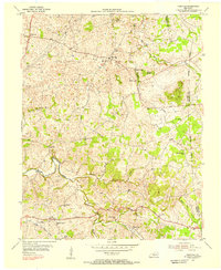 1954 Hiseville1956 Print · USGSBarren and Metcalfe counties come alive in the mid-fifties, showing a landscape of established family farms and small rural crossroads. Researchers can trace ancestral locations near Hiseville, the State Fish Hatchery, and several schools like Dry Hollow Sch.2 unique versions available
 - 1954 Map of Lucas, 1964 Print
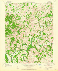 1954 Lucas1964 Print · USGSThe Barren River valley in the mid-fifties still maintained its intricate network of rural schools and winding creek-side settlements. Genealogists and local historians can trace the foundations of communities like Railton and Lucas or locate landmarks such as Old Zion Ch and the Narrows.
Showing maps 1-25 of 149
Top cities of Barren County
Frequently asked questions
- What are the different types of historical maps available for Barren County?
- What is the oldest map of Barren County?
- Where can I purchase historical maps of Barren County for my home or office?
- Where can I download high-res historical maps of Barren County?
- Are there historical topographic maps available for Barren County?
- Is there historical aerial imagery available for Barren County?
- Where are historical maps of Barren County sourced from?