1970s Maps of Barren County, Kentucky
Explore 8 historic maps of Barren County from the 1970s. These maps offer a rare glimpse into what life looked like during the 1970s — showing old roads, neighborhoods, homes, and landmarks that have changed or disappeared over time.
Whether you're researching your family's past, planning a metal detecting trip, or studying how Barren County's landscape evolved across the 1970s, these high-resolution maps are a powerful tool for exploring the history of this region.
- Focus on a specific era: All maps on this page are from the 1970s, giving you a focused view of this time period.
- See what’s changed: Compare century-old streets, trails, and buildings to today's modern landscape using overlays and satellite layers.
- Research with precision: Use these maps for genealogy, historical research, land use analysis, or educational projects.
- View, download, or print: Maps are fully viewable online in high resolution, and can be downloaded or printed for your own records.
Start exploring Barren County's history through authentic maps from the 1970s. This is your window into the past.
Barren County, KY maps
(8)- 1973 Map of Hiseville, 1974 Print
 1973 Hiseville1974 Print · USGSThe Barren and Metcalfe county line comes alive in the early seventies, showing a landscape of sinkholes and knobs. Trace family roots at Queens Chapel, Griderville, or the oil-producing fields near Coral Hill.2 unique versions available
 - 1973 Map of Glasgow North, 1974 Print
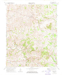
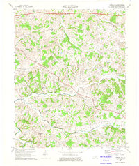
 1973 Glasgow North1974 Print · USGSBarren County in the early seventies shows a landscape shaped by petroleum extraction and karst geography. Researchers can find many family-named country churches like Mt Tabor Ch, local landmarks like Crystal Onyx Cave, and the small settlement of Goodnight.2 unique versions available
 - 1973 Map of Park City, 1974 Print
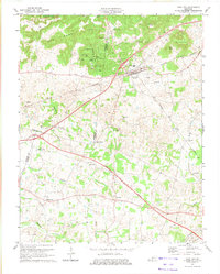 1973 Park City1974 Print · USGSPark City and the surrounding knobs of Barren County are captured in the early seventies, just as the regional highway network was expanding. Genealogists and cave enthusiasts can trace family sites and local landmarks like Diamond Caverns, Zion Cem Ch, and the rural community of Merry Oaks.
 - 1973 Map of Sulphur Well, 1975 Print
 1973 Sulphur Well1975 Print · USGSMetcalfe County's rural crossroads and river valleys are captured here in the early 1970s. Researchers can trace the layout of small settlements like Sulphur Well and Wisdom or locate family sites near Ebenezer Ch and Knob Lick.2 unique versions available
 - 1973 Map of Temple Hill, 1975 Print
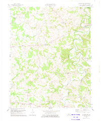
 1973 Temple Hill1975 Print · USGSTemple Hill and the surrounding Barren County countryside are captured here in the early 1970s as modern infrastructure began to reshape the rural landscape. Genealogists and local historians can trace family-named sites like Barbour Cem, the remote Saltpeter Cave, and country schools including Eastern Sch.2 unique versions available
 - 1973 Map of Glasgow South, 1975 Print
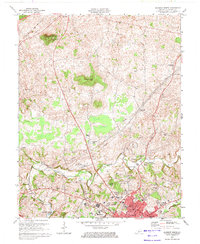
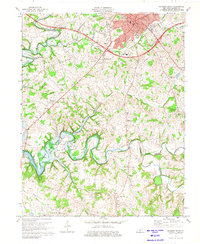 1973 Glasgow South1975 Print · USGSMid-century Barren County shows the growth of Glasgow and the surrounding rural communities of Bristletown and Haywood during a period of industrial change. Genealogists can locate family landmarks like Sloan Ch, Terry Sch, and the South Fork Cem.2 unique versions available
 - 1974 Map of Summer Shade, 1975 Print
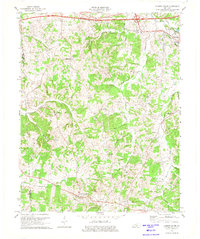 1974 Summer Shade1975 Print · USGSSouthern Metcalfe County is captured here in the mid-seventies, showing a landscape of ridge-top farms and deep creek hollows. Genealogists and historians can trace family locations near Summer Shade, Hickory College Ch, and the old Metcalfe County Ford.
 - 1979 Map of Tracy, 1984 Print
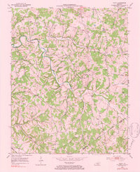 1979 Tracy1984 Print · USGSBarren and Monroe Counties remained deeply rural in the mid-twentieth century, centered on small creek-side communities and family homesteads. Genealogists can trace historical family locations through sites like Kinslow Cem and Moore Sch near Tracy and Etoile.
End of results
Showing maps 1-8 of 8
Top cities of Barren County
Frequently asked questions
- What are the different types of historical maps available for Barren County?
- What is the oldest map of Barren County?
- Where can I purchase historical maps of Barren County for my home or office?
- Where can I download high-res historical maps of Barren County?
- Are there historical topographic maps available for Barren County?
- Is there historical aerial imagery available for Barren County?
- Where are historical maps of Barren County sourced from?