1960s Maps of Barren County, Kentucky
Explore 11 historic maps of Barren County from the 1960s. These maps offer a rare glimpse into what life looked like during the 1960s — showing old roads, neighborhoods, homes, and landmarks that have changed or disappeared over time.
Whether you're researching your family's past, planning a metal detecting trip, or studying how Barren County's landscape evolved across the 1960s, these high-resolution maps are a powerful tool for exploring the history of this region.
- Focus on a specific era: All maps on this page are from the 1960s, giving you a focused view of this time period.
- See what’s changed: Compare century-old streets, trails, and buildings to today's modern landscape using overlays and satellite layers.
- Research with precision: Use these maps for genealogy, historical research, land use analysis, or educational projects.
- View, download, or print: Maps are fully viewable online in high resolution, and can be downloaded or printed for your own records.
Start exploring Barren County's history through authentic maps from the 1960s. This is your window into the past.
Barren County, KY maps
(11)- 1960 Map of Winchester
 1960 Winchester1960 Print · USGSCentral Kentucky's diverse landscape is shown here at mid-century, from the bluegrass plains to the rugged Pottsville Escarpment. Genealogists and historians can trace the rail-and-river network connecting towns like Bardstown and Stanford alongside landmarks like Lake Cumberland.
 - 1961 Map of Evansville
 1961 Evansville1961 Print · USGSThe Ohio River valley and its surrounding coalfields are captured here during the late fifties and early sixties. Trace the industrial rail networks of the Illinois Central RR and explore regional landmarks like Mammoth Cave National Park and Angel Mounds State Memorial.2 unique versions available
 - 1961 Map of Center, 1963 Print
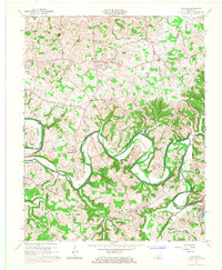
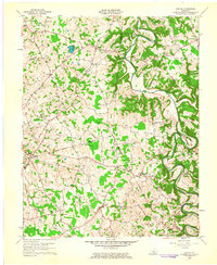 1961 Center1963 Print · USGSThe rural borderlands of Hart, Green, and Metcalfe counties are captured here in the early sixties, showing a landscape defined by river bends and country crossroads. Researchers can locate dozens of family burial sites like Sydnor Cem or trace the early energy infrastructure around Whickerville and Center.4 unique versions available
 - 1965 Map of Glasgow North, 1966 Print
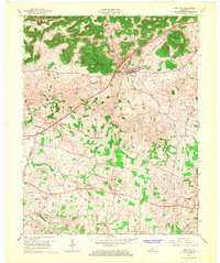
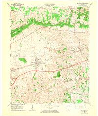
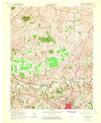 1965 Glasgow North1966 Print · USGSBarren County's karst landscape and rural crossroads are captured here during a period of mid-century growth north of Glasgow. Researchers can trace family history through local landmarks like Goodnight, Oil City, and rural churches such as Harlow Chapel and Salem Ch.
 - 1965 Map of Glasgow South, 1967 Print
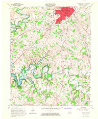 1965 Glasgow South1967 Print · USGSBarren County during the mid-sixties shows the growth of Glasgow alongside a robust rural petroleum economy. Genealogists and local historians can trace family locations near Pritchardsville, Barlow Cem, and schools like Bunche High Sch.
 - 1965 Map of Austin, 1967 Print
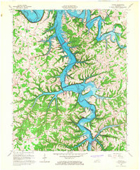 1965 Austin1967 Print · USGSBarren and Allen Counties are shown in the mid-1960s as the rising waters of the Barren River Reservoir reshaped the valley. Genealogists and local historians can trace family locations near Austin, Cedar Cross Cem, and Capitol Hill Ch.4 unique versions available
 - 1965 Map of Meador, 1967 Print
 1965 Meador1967 Print · USGSThe Barren River valley in the mid-1960s shows a landscape transformed by the creation of the Barren River Reservoir. Genealogists and local historians can trace family locations near Meador, Martinsville, and rural landmarks like Mt Zion Ch or the Martinsville Ford.
 - 1965 Map of Mammoth Cave, 1973 Print
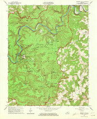 1965 Mammoth Cave1973 Print · USGSThe heart of Kentucky's cave country is captured here in the mid-1960s, showing the early infrastructure and historic portals of the national park. Genealogists and historians can trace old homesteads and family burial grounds like Holton Cem or visit rural congregations at Little Hope Ch and Freedom Ch.2 unique versions available
 - 1966 Map of Park City, 1968 Print
 1966 Park City1968 Print · USGSBarren and Edmonson counties are captured in the mid-sixties, where the gateway to the cavern country meets the rail lines. Genealogists can trace family landmarks like Cox Cem and rural congregations including Mt Vernon Ch and Woodland Ch.
 - 1966 Map of Horse Cave, 1968 Print
 1966 Horse Cave1968 Print · USGSThe karst country of Hart and Barren Counties is captured here in the mid-sixties, centered on the historic rail corridor. Genealogists and historians can locate family landmarks like Sargent Valley Ch, Rowletts, and the grounds of Mammoth Onyx Cave.
 - 1966 Map of Smiths Grove, 1968 Print
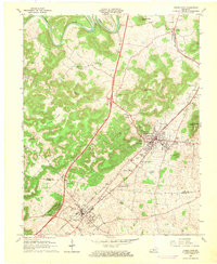
 1966 Smiths Grove1968 Print · USGSIn the mid-1960s, the Smiths Grove area of Warren County was a landscape of karst springs and growing oil exploration along the Louisville and Nashville line. Genealogists can trace family names at Kinser Cem and Lambert Cem or locate old rural congregations like New Grove Ch and Liberty Ch.3 unique versions available
End of results
Showing maps 1-11 of 11
Top cities of Barren County
Frequently asked questions
- What are the different types of historical maps available for Barren County?
- What is the oldest map of Barren County?
- Where can I purchase historical maps of Barren County for my home or office?
- Where can I download high-res historical maps of Barren County?
- Are there historical topographic maps available for Barren County?
- Is there historical aerial imagery available for Barren County?
- Where are historical maps of Barren County sourced from?