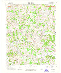
1973 Map of Temple Hill
USGS Topo · Published 1975About this map
The community of Temple Hill serves as a central point in this Barren County landscape, which by 1973 was undergoing significant modern transitions. The most prominent infrastructural addition is the Cumberland Parkway Toll Road, which bisects the northern reaches of the quadrangle near New Salem. This modern corridor contrasts with the established network of rural country roads connecting historic gathering places like Beech Grove Ch, Whites Chapel, and New Salem Ch.
Find a feature on this map
36 named features on this map. Tap any name to fly to it.
Don’t see what you’re looking for? This feature index may not catch every label — zoom into the map to look around manually.
Map Details
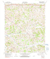
Editions of this 1973 Temple Hill Map
2 editions found
Other maps of this area

1935 · Horse Cave
USGS Topo · 1:48,000

1938 · Horse Cave
USGS Topo · 1:62,500

1953 · Sulphur Well
USGS Topo · 1:24,000

1953 · Tracy
USGS Topo · 1:24,000

1953 · Sulphur Lick
USGS Topo · 1:24,000

1953 · Temple Hill
USGS Topo · 1:24,000

1953 · Glasgow South
USGS Topo · 1:24,000

1953 · Freedom
USGS Topo · 1:24,000

1953 · Summer Shade
USGS Topo · 1:24,000
1954 · Glasgow North
USGS Topo · 1:24,000