
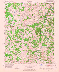
1953 Map of Sulphur Well
USGS Topo · Published 1954About this map
The winding Little Barren River carves through the Metcalfe County landscape, defining the character of this rural region in the early 1950s. The settlement of Sulphur Well sits along its banks, near a dense concentration of family-named cemeteries and community schools that speak to the established agricultural roots of the area. Landforms like Buck Hill and the waters of Ten Acre Branch break up the terrain, while the presence of scattered Gas Wells and a Quarry indicates the active extraction of local resources.
Find a feature on this map
46 named features on this map. Tap any name to fly to it.
Don’t see what you’re looking for? This feature index may not catch every label — zoom into the map to look around manually.
Map Details
Editions of this 1953 Sulphur Well Map
2 editions found
Other maps of this area

1935 · Horse Cave
USGS Topo · 1:48,000

1938 · Horse Cave
USGS Topo · 1:62,500

1953 · Temple Hill
USGS Topo · 1:24,000

1953 · Edmonton
USGS Topo · 1:24,000

1953 · Summer Shade
USGS Topo · 1:24,000

1953 · Exie
USGS Topo · 1:24,000

1953 · Center
USGS Topo · 1:24,000

1953 · East Fork
USGS Topo · 1:24,000

1954 · Park
USGS Topo · 1:24,000
1954 · Hiseville
USGS Topo · 1:24,000