
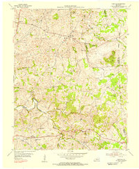
1953 Map of Summer Shade
USGS Topo · Published 1955About this map
Summer Shade sits at the southern end of a landscape defined by deep-set stream valleys and narrow ridges in Metcalfe and Barren Counties. During the early 1950s, this area of south-central Kentucky supported a decentralized network of rural communities such as Randolph, Goodluck, and Evansville. The map documents a high density of local schools and churches that served as social anchors for these hollows, including Cedar Hill Sch, Hickory College Ch, and Missionary Mound Ch. Geologic features like Cave Ridge and Harvey Cave indicate the region's karst topography, where drainage from Falling Timber Creek and Clay Lick Creek feeds into the South Fork Little Barren River. The presence of many family cemeteries, including the Perkins Cem and Branstetter Cem, offers significant genealogical detail for researchers tracing families between the Glover Creek and Rogers Creek watersheds.
Find a feature on this map
42 named features on this map. Tap any name to fly to it.
Don’t see what you’re looking for? This feature index may not catch every label — zoom into the map to look around manually.
Map Details
Editions of this 1953 Summer Shade Map
This is the sole edition of this map. No revisions or reprints were ever made.
Other maps of this area

1935 · Horse Cave
USGS Topo · 1:48,000

1938 · Horse Cave
USGS Topo · 1:62,500

1953 · Sulphur Well
USGS Topo · 1:24,000

1953 · Sulphur Lick
USGS Topo · 1:24,000

1953 · Temple Hill
USGS Topo · 1:24,000

1953 · Freedom
USGS Topo · 1:24,000

1953 · Edmonton
USGS Topo · 1:24,000

1953 · Dubre
USGS Topo · 1:24,000

1953 · East Fork
USGS Topo · 1:24,000
1954 · Hiseville
USGS Topo · 1:24,000