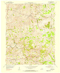
1954 Map of Hiseville
USGS Topo · Published 1956About this map
The community of Hiseville serves as the central hub for this Barren County landscape during the mid-1950s, where the intersection of the Jackson Highway and Memorial Highway defines the local travel pattern. The terrain is characterized by a dense network of small family cemeteries and rural institutions, including the Pleasant Union Sch and Dry Hollow Sch. Waterways like Beaver Creek and Blue Spring Creek wind through a landscape dotted with localized peaks such as Winlock Knob and Buck Knob.
Find a feature on this map
32 named features on this map. Tap any name to fly to it.
Don’t see what you’re looking for? This feature index may not catch every label — zoom into the map to look around manually.
Map Details
Editions of this 1954 Hiseville Map
2 editions found
Other maps of this area

1935 · Horse Cave
USGS Topo · 1:48,000

1938 · Horse Cave
USGS Topo · 1:62,500

1953 · Sulphur Well
USGS Topo · 1:24,000

1953 · Temple Hill
USGS Topo · 1:24,000

1953 · Glasgow South
USGS Topo · 1:24,000

1953 · Summer Shade
USGS Topo · 1:24,000

1953 · Center
USGS Topo · 1:24,000

1954 · Park
USGS Topo · 1:24,000

1954 · Horse Cave
USGS Topo · 1:24,000
1954 · Glasgow North
USGS Topo · 1:24,000