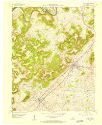
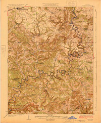
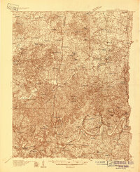
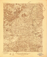
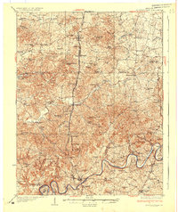
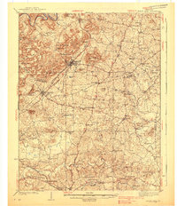
1954 Map of Horse Cave
USGS Topo · Published 1955About this map
Horse Cave and Cave City anchor this mid-century topographic portrait of Hart and Barren Counties, situated along the vital Louisville and Nashville railroad corridor. The landscape is defined by its karst topography, featuring numerous sinks and cavern systems like the Mammoth Onyx Cave and Ice Cave hidden beneath Fisher Ridge. To the north, the Green River carves deep loops through the terrain at Mansfield Bend and Lowlar Bend, while the surrounding hills are dotted with isolated knobs such as Gossett Knob and Huckleberry Knob. The map reveals a dense network of rural infrastructure, including many community landmarks like Cave Spring Ch and the Hatcher Valley Sch. This era captures the transition of the regional economy, where traditional river-and-rail transport met the growing importance of the Dixie Highway, facilitating travel through this unique geological corridor.
Find a feature on this map
34 named features on this map. Tap any name to fly to it.
Don’t see what you’re looking for? This feature index may not catch every label — zoom into the map to look around manually.
Map Details
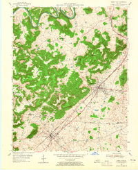
Editions of this 1954 Horse Cave Map
2 editions found
Other maps of this area
1922 · Mammoth Cave
USGS Topo · 1:62,500
1923 · Mammoth Cave
USGS Topo · 1:62,500
1925 · Cub Run
USGS Topo · 1:62,500
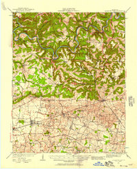
1934 · Munfordville
USGS Topo · 1:48,000
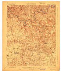
1935 · Horse Cave
USGS Topo · 1:48,000
1937 · Munfordville
USGS Topo · 1:62,500
1938 · Horse Cave
USGS Topo · 1:62,500
1953 · Munfordville
USGS Topo · 1:24,000
1953 · Canmer
USGS Topo · 1:24,000

1954 · Evansville
USGS Topo · 1:250,000