Old Maps of Hart County, Kentucky
Explore 102 old maps of Hart County, spanning from 1922 to today. These high-resolution historic maps reveal how streets, neighborhoods, landmarks, and natural features evolved over time — perfect for genealogy, metal detecting, research, and local history exploration.
What you can do with these maps:
- See how Hart County changed over time: Compare historical maps to modern-day views to trace roads, homesites, rail lines & more.
- View detailed metadata: Each map includes creators, publishers, year, scale, and archive source.
- Overlay maps with satellite & LiDAR: Visualize the past alongside modern tools to explore terrain & human change.
- Trusted historical sources: Maps sourced from the USGS, Library of Congress, and other archives.
- Access maps your way: View online, download high-res files, or order prints for personal or research use.
Start exploring old maps of Hart County to uncover forgotten places, hidden landmarks, and the deep history beneath your feet.
Hart County, KY maps
(102)- 1922 Map of Mammoth Cave, 1957 Print
 1922 Mammoth Cave1957 Print · USGSThe Green River valley and the Kentucky karst country are captured here in the early 1920s, before the full development of the national park. Researchers can trace family-named landmarks and long-established crossings like Fishtrap Ferry, Good Spring Church, and the world-renowned Mammoth Cave.7 unique versions available
 - 1923 Map of Mammoth Cave
 1923 Mammoth Cave1923 Print · USGSThe subterranean wonders of Edmonson County are mapped in the early 1920s alongside the river ferries and rail towns of the Kentucky karst. Family historians can trace ancestral roots through dozens of local landmarks like Good Spring Church, Ollie School, and Houchins Ferry.6 unique versions available
 - 1925 Map of Cub Run
 1925 Cub Run1925 Print · USGSCentral Kentucky's rural landscape is captured here in the mid-1920s, dominated by the intricate loops of the Nolin River. Genealogists and historians can locate numerous family-named landmarks like Dickeys Mills, Sanders Store, and Hester School.3 unique versions available
 - 1934 Map of Munfordville
 1934 Munfordville1934 Print · USGSHart County communities line the corridor of the Green River and the Nashville Road during the mid-1930s. Genealogists can trace family footprints through dozens of local landmarks like Poundstone Roller Mill, Big Springs Cem, and Priceville.
 - 1935 Map of Horse Cave
 1935 Horse Cave1935 Print · USGSHart and Barren counties in the mid-1930s reveal a landscape shaped by cave tourism and rural education. Genealogists can trace family footprints through dozens of local landmarks like Ragman Seminary, Bunnells Crossing, and New Hope Ch.
 - 1937 Map of Munfordville
 1937 Munfordville1937 Print · USGSThe Green River valley in the 1930s was a landscape of river fords and knob-country schools. Genealogists can trace family footprints across dozens of local sites like Falling Springs Ch, Big Springs Cem, and the old Rider Mill.
 - 1938 Map of Horse Cave
 1938 Horse Cave1938 Print · USGSKentucky's cave country thrives in the late 1930s as a hub of early auto tourism and rail commerce. Genealogists can trace family roots through dozen of rural landmarks like Walton Academy, Mammoth Onyx Cave, and the Big Meadow Ch.2 unique versions available
 - 1953 Map of Hudgins, 1954 Print
 1953 Hudgins1954 Print · USGSThe Green River loops through Hart and Green Counties in the early fifties, carving deep bends like The Narrows. Researchers can trace old family lines through dozens of sites including Halltown Cem, Aetna Grove Ch, and the settlement at Hudgins.
 - 1953 Map of Munfordville, 1955 Print
 1953 Munfordville1955 Print · USGSMid-century Hart County centers on the vital river crossing at Munfordville as the regional economy shifts between rail and highway. Local historians can trace family sites like Puckett Cem, the Euclid Sch, and the Civil War Monument.2 unique versions available
 - 1953 Map of Magnolia, 1955 Print
 1953 Magnolia1955 Print · USGSLarue and Hart counties are captured here in the early 1950s, showing a landscape defined by the South Fork Nolin River and rural ridge-top life. Researchers can trace family roots through landmarks like Aetna Furnace, Holly Grove Cem, and the community around Magnolia.
 - 1953 Map of Center, 1955 Print
 1953 Center1955 Print · USGSHart and Metcalfe counties come alive in the mid-fifties as a landscape of remote farmsteads and river bends. Genealogists can locate family landmarks like Allens Grove Ch, Bastin Cem, and the small settlement of Whickerville.
 - 1953 Map of Canmer, 1955 Print
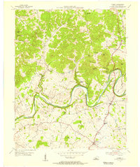 1953 Canmer1955 Print · USGSHart County communities thrived along the winding Green River corridor during the mid-fifties. Genealogists and local historians can trace rural family life through landmarks like Memorial Sch, Crump Cem, and the village of Hardyville.4 unique versions available
 - 1954 Map of Evansville
 1954 Evansville1954 Print · USGSThe Ohio River borderlands between Indiana and Kentucky appear here during a period of robust industrial and military growth. Genealogists and researchers can trace the rail corridors of the Illinois Central and find landmarks like US Lock and Dam No 48 or Camp Breckinridge.
 - 1954 Map of Park, 1955 Print
 1954 Park1955 Print · USGSSouth-central Kentucky during the mid-fifties reveals a landscape of limestone sinkholes and prominent knobs at the junction of two major early highways. Trace family roots at Bear Wallow, find the Oak Ridge Sch, or locate numerous early Oil Wells around Rex.2 unique versions available
 - 1954 Map of Horse Cave, 1955 Print
 1954 Horse Cave1955 Print · USGSMid-century Kentucky karst country is on full display here, capturing the area between Horse Cave and Cave City at a peak of local rail and road travel. Genealogists and historians can locate numerous rural landmarks like Our Lady of the Caves Ch, Northtown, and the winding Green River loops.2 unique versions available
 - 1954 Map of Upton, 1955 Print
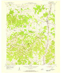 1954 Upton1955 Print · USGSCentered on the Hardin and Hart county line in the mid-fifties, this area shows a landscape of rail-linked towns and karst springs. Researchers can trace family history through sites like Lucas Grove Ch, Upton Cem, and the old mill at Riders Mill.
 - 1954 Map of Dickeys Mills, 1955 Print
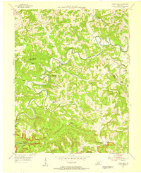 1954 Dickeys Mills1955 Print · USGSThe Nolin River loops through the Kentucky karst country in the mid-fifties, just north of the legendary cave system. Trace family roots at Demunbruns Store, Temple Hill Ch, and cemeteries like Washington Meredith Cem.2 unique versions available
 - 1954 Map of Hammonville, 1955 Print
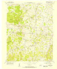 1954 Hammonville1955 Print · USGSThe borderlands of Larue and Hart Counties come into focus during the mid-fifties, capturing a landscape of family farms and rural missions. Researchers can trace ancestral roots at Pleasant Valley Cem, Hodge Cem, and the hilltop Oak Hill Mission.3 unique versions available
 - 1954 Map of Cub Run, 1955 Print
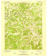 1954 Cub Run1955 Print · USGSHart County and the surrounding Kentucky hills appear here in the mid-1950s, centered on the tight meanders of the Nolin River. Genealogists and local historians can trace rural family landmarks like Lines Mill, Broad Ford Sch, and Macedonia Ch.2 unique versions available
 - 1954 Map of Millerstown, 1955 Print
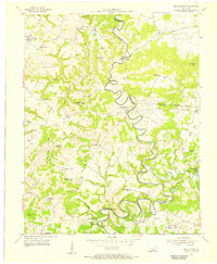 1954 Millerstown1955 Print · USGSThe Nolin River meanders through the central Kentucky highlands during the mid-fifties, bordering Hardin and Grayson counties. Researchers can trace old river crossings at Broad Ford or locate rural landmarks like Wheelers Mill and Little Clifty Ch.
 - 1957 Map of Winchester, 1968 Print
 1957 Winchester1968 Print · USGSCentral Kentucky's landscape in the mid-twentieth century features the sprawling Fort Knox and the early parkway system. Genealogists and historians can trace rail lines like the Southern Railway and find landmarks from Bernheim Forest to Pilot Knob.3 unique versions available
 - 1957 Map of Evansville, 1969 Print
 1957 Evansville1969 Print · USGSIndiana and Kentucky meet along the Ohio River in this mid-century survey of a vital industrial and transport corridor. Genealogists and historians can trace the development of river towns like Owensboro and Newburgh or locate old rail lines like the Southern Ry.3 unique versions available
 - 1960 Map of Winchester
 1960 Winchester1960 Print · USGSCentral Kentucky's diverse landscape is shown here at mid-century, from the bluegrass plains to the rugged Pottsville Escarpment. Genealogists and historians can trace the rail-and-river network connecting towns like Bardstown and Stanford alongside landmarks like Lake Cumberland.
 - 1961 Map of Evansville
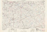 1961 Evansville1961 Print · USGSThe Ohio River valley and its surrounding coalfields are captured here during the late fifties and early sixties. Trace the industrial rail networks of the Illinois Central RR and explore regional landmarks like Mammoth Cave National Park and Angel Mounds State Memorial.2 unique versions available
 - 1961 Map of Magnolia, 1963 Print
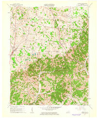 1961 Magnolia1963 Print · USGSMagnolia and Mount Sherman are shown here in the early 1960s as the local landscape integrated industrial gas storage into its rural character. Researchers can locate family landmarks like Russell Cem and historic community hubs such as Aetna Furnace or Benningfield Chapel.2 unique versions available
Showing maps 1-25 of 102
Top cities of Hart County
Frequently asked questions
- What are the different types of historical maps available for Hart County?
- What is the oldest map of Hart County?
- Where can I purchase historical maps of Hart County for my home or office?
- Where can I download high-res historical maps of Hart County?
- Are there historical topographic maps available for Hart County?
- Is there historical aerial imagery available for Hart County?
- Where are historical maps of Hart County sourced from?