1960s Maps of Hart County, Kentucky
Explore 12 historic maps of Hart County from the 1960s. These maps offer a rare glimpse into what life looked like during the 1960s — showing old roads, neighborhoods, homes, and landmarks that have changed or disappeared over time.
Whether you're researching your family's past, planning a metal detecting trip, or studying how Hart County's landscape evolved across the 1960s, these high-resolution maps are a powerful tool for exploring the history of this region.
- Focus on a specific era: All maps on this page are from the 1960s, giving you a focused view of this time period.
- See what’s changed: Compare century-old streets, trails, and buildings to today's modern landscape using overlays and satellite layers.
- Research with precision: Use these maps for genealogy, historical research, land use analysis, or educational projects.
- View, download, or print: Maps are fully viewable online in high resolution, and can be downloaded or printed for your own records.
Start exploring Hart County's history through authentic maps from the 1960s. This is your window into the past.
Hart County, KY maps
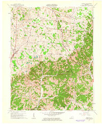
(12)- 1960 Map of Winchester
 1960 Winchester1960 Print · USGSCentral Kentucky's diverse landscape is shown here at mid-century, from the bluegrass plains to the rugged Pottsville Escarpment. Genealogists and historians can trace the rail-and-river network connecting towns like Bardstown and Stanford alongside landmarks like Lake Cumberland.
 - 1961 Map of Evansville
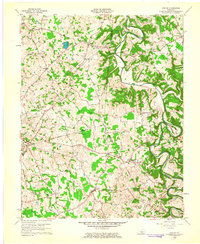
 1961 Evansville1961 Print · USGSThe Ohio River valley and its surrounding coalfields are captured here during the late fifties and early sixties. Trace the industrial rail networks of the Illinois Central RR and explore regional landmarks like Mammoth Cave National Park and Angel Mounds State Memorial.2 unique versions available
 - 1961 Map of Magnolia, 1963 Print
 1961 Magnolia1963 Print · USGSMagnolia and Mount Sherman are shown here in the early 1960s as the local landscape integrated industrial gas storage into its rural character. Researchers can locate family landmarks like Russell Cem and historic community hubs such as Aetna Furnace or Benningfield Chapel.2 unique versions available
 - 1961 Map of Center, 1963 Print
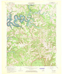
 1961 Center1963 Print · USGSThe rural borderlands of Hart, Green, and Metcalfe counties are captured here in the early sixties, showing a landscape defined by river bends and country crossroads. Researchers can locate dozens of family burial sites like Sydnor Cem or trace the early energy infrastructure around Whickerville and Center.4 unique versions available
 - 1961 Map of Hudgins, 1963 Print
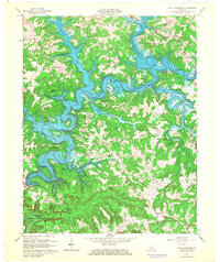
 1961 Hudgins1963 Print · USGSCentral Kentucky's river-cut landscape is documented here in the early sixties, showing the tight meanders of the GREEN RIVER. Researchers can trace dozens of family cemeteries and rural landmarks like Three Hundred Springs, Powder Mill, and Aetna Grove Ch.
 - 1965 Map of Mammoth Cave, 1973 Print
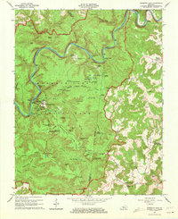 1965 Mammoth Cave1973 Print · USGSThe heart of Kentucky's cave country is captured here in the mid-1960s, showing the early infrastructure and historic portals of the national park. Genealogists and historians can trace old homesteads and family burial grounds like Holton Cem or visit rural congregations at Little Hope Ch and Freedom Ch.2 unique versions available
 - 1966 Map of Munfordville, 1968 Print
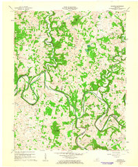
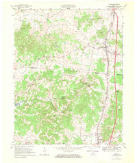
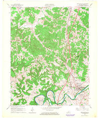 1966 Munfordville1968 Print · USGSThe Green River corridor and the Louisville and Nashville rail line define this Hart County landscape during the mid-1960s. Genealogists and local historians can trace family roots at Rocky Hill Ch, locate the Civil War Monument, or find old school sites like Carters Dowling Sch.
 - 1966 Map of Cub Run, 1968 Print
 1966 Cub Run1968 Print · USGSCentral Kentucky's rural landscape is captured here in the mid-1960s as the Nolin River Reservoir reshaped the valley. Researchers can trace old family sites near Cub Run, Big Windy, and rural pulpits like St Benedicts Ch.
 - 1966 Map of Nolin Reservoir, 1968 Print
 1966 Nolin Reservoir1968 Print · USGSEdmonson County landscape changed forever in the mid-1960s as the reservoir waters filled the deep valleys of the Nolin River. Genealogists and hikers can locate the Lincoln Sch, trace the Mammoth Cave National Park boundary near Ollie, and find the remote Demunbruns Store.3 unique versions available
 - 1966 Map of Horse Cave, 1968 Print
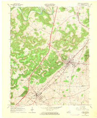 1966 Horse Cave1968 Print · USGSThe karst country of Hart and Barren Counties is captured here in the mid-sixties, centered on the historic rail corridor. Genealogists and historians can locate family landmarks like Sargent Valley Ch, Rowletts, and the grounds of Mammoth Onyx Cave.
 - 1967 Map of Upton, 1969 Print
 1967 Upton1969 Print · USGSUpton and Bonnieville are captured in the late sixties along the Louisville and Nashville rail line. Genealogy researchers can trace family landmarks and rural hubs like Lone Star, Riders Mill, and Stoney Point Ch.2 unique versions available
 - 1967 Map of Millerstown, 1971 Print
 1967 Millerstown1971 Print · USGSKentucky's Nolin River valley is captured here in the late sixties as the new reservoir began to alter the local landscape. Researchers can trace ancestral locations across three counties, locating old landmarks like Riders Mill, Broad Ford Ch, and Mt Zion Cem.3 unique versions available
End of results
Showing maps 1-12 of 12
Top cities of Hart County
Frequently asked questions
- What are the different types of historical maps available for Hart County?
- What is the oldest map of Hart County?
- Where can I purchase historical maps of Hart County for my home or office?
- Where can I download high-res historical maps of Hart County?
- Are there historical topographic maps available for Hart County?
- Is there historical aerial imagery available for Hart County?
- Where are historical maps of Hart County sourced from?