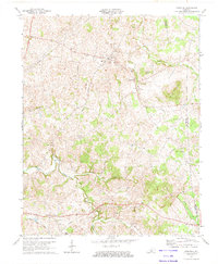
1973 Map of Hiseville
USGS Topo · Published 1974About this map
Hiseville serves as the central hub of this Barren County landscape, characterized by a complex network of karst topography and rural settlements. The terrain is marked by distinctive features like Winlock Knob and the unusual Underground Branch, reflecting the region's subterranean drainage patterns. This 1970s survey documents a landscape balancing agricultural use with energy extraction, evidenced by numerous Oil Wells and Gas Wells scattered across the quadrangle. Local social centers are well-defined by a high density of country churches, including Pleasant Union Ch and Big Meadow Ch, which often served as the primary landmarks for surrounding families. The passage of the Cumberland Parkway across the southern portion of the map indicates the modern infrastructure beginning to overlay older patterns of travel near Leota and Coral Hill.
Find a feature on this map
36 named features on this map. Tap any name to fly to it.
Don’t see what you’re looking for? This feature index may not catch every label — zoom into the map to look around manually.
Map Details
Editions of this 1973 Hiseville Map
2 editions found
Other maps of this area

1935 · Horse Cave
USGS Topo · 1:48,000

1938 · Horse Cave
USGS Topo · 1:62,500

1953 · Sulphur Well
USGS Topo · 1:24,000

1953 · Temple Hill
USGS Topo · 1:24,000

1953 · Glasgow South
USGS Topo · 1:24,000

1953 · Summer Shade
USGS Topo · 1:24,000

1953 · Center
USGS Topo · 1:24,000

1954 · Park
USGS Topo · 1:24,000

1954 · Horse Cave
USGS Topo · 1:24,000
1954 · Glasgow North
USGS Topo · 1:24,000