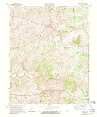
1973 Map of Hiseville
USGS Topo · Published 1990About this map
Hiseville serves as the central hub of this Barren County landscape, surveyed in the early 1970s. The region is defined by a dense network of country churches and small rural crossroads such as Lecta, Griderville, and Slick Rock. Topographically, the land is marked by prominent elevations like Winlock Knob and Buck Knob, while the intricate drainage of Beaver Creek and its tributary Barren Fork carves through the undulating terrain. A significant infrastructure of Gas Wells and Pipelines crisscrosses the map, particularly near the Barren Co and Metcalfe Co line, indicating the importance of local mineral extraction. Genealogists will find numerous unnamed cemeteries and community landmarks such as Hickory Grove Ch and Queens Chapel, providing a detailed view of the social fabric of this Kentucky community before the modernization of the late 20th century.
Find a feature on this map
33 named features on this map. Tap any name to fly to it.
Don’t see what you’re looking for? This feature index may not catch every label — zoom into the map to look around manually.
Map Details
Editions of this 1973 Hiseville Map
2 editions found
Other maps of this area

1935 · Horse Cave
USGS Topo · 1:48,000

1938 · Horse Cave
USGS Topo · 1:62,500

1953 · Sulphur Well
USGS Topo · 1:24,000

1953 · Temple Hill
USGS Topo · 1:24,000

1953 · Glasgow South
USGS Topo · 1:24,000

1953 · Summer Shade
USGS Topo · 1:24,000

1953 · Center
USGS Topo · 1:24,000

1954 · Park
USGS Topo · 1:24,000

1954 · Horse Cave
USGS Topo · 1:24,000
1954 · Glasgow North
USGS Topo · 1:24,000