
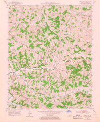
1953 Map of Temple Hill
USGS Topo · Published 1954About this map
Temple Hill and the uniquely named settlement of Eighty Eight anchor this rural landscape in Barren County during the early 1950s. The area is characterized by a dense network of country churches and schools that served as the social fabric of these agricultural communities. Educational landmarks like the Forest Seminary Sch and Vernon Sch appear alongside numerous places of worship, including New Salem Ch, Mt Union No 3 Ch, and Whites Chapel.
Find a feature on this map
39 named features on this map. Tap any name to fly to it.
Don’t see what you’re looking for? This feature index may not catch every label — zoom into the map to look around manually.
Map Details
Editions of this 1953 Temple Hill Map
2 editions found
Other maps of this area

1935 · Horse Cave
USGS Topo · 1:48,000

1938 · Horse Cave
USGS Topo · 1:62,500

1953 · Sulphur Well
USGS Topo · 1:24,000

1953 · Tracy
USGS Topo · 1:24,000

1953 · Sulphur Lick
USGS Topo · 1:24,000

1953 · Glasgow South
USGS Topo · 1:24,000

1953 · Freedom
USGS Topo · 1:24,000

1953 · Summer Shade
USGS Topo · 1:24,000
1954 · Glasgow North
USGS Topo · 1:24,000
1954 · Hiseville
USGS Topo · 1:24,000