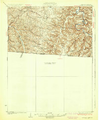
1931 Map of Lafayette
USGS Topo · Published 1931About this map
The Barren River and its intricate drainage network define this 1928 survey of the borderlands between Allen County, Kentucky, and Macon County, Tennessee. The landscape is characterized by a high density of rural social institutions, with dozens of one-room schoolhouses like Hickory Hill Sch and White Plains Sch serving dispersed farming families. The Louisville and Nashville RR cuts through the western section, supporting small settlements such as Petroleum. Unique geological features are also noted, including the Natural Bridge and a prominent depression known as The Sink, located near Dewsharp Bend. The concentration of community centers, from Union Chapel to Mt Pleasant Ch, reflects a period before the consolidation of rural districts, providing a precise look at the early 20th-century social geography of this upland region.
Find a feature on this map
48 named features on this map. Tap any name to fly to it.
Don’t see what you’re looking for? This feature index may not catch every label — zoom into the map to look around manually.
Map Details
Editions of this 1931 Lafayette Map
2 editions found
Other maps of this area

1921 · Bowling Green
USGS Topo · 1:62,500

1923 · Bowling Green
USGS Topo · 1:62,500

1926 · Scottsville
USGS Topo · 1:62,500

1928 · Adolphus
USGS Topo · 1:48,000

1931 · Lafayette
USGS Topo · 1:62,500

1931 · Adolphus
USGS Topo · 1:62,500

1931 · Red Boiling Springs
USGS Topo · 1:62,500

1932 · Carthage
USGS Topo · 1:62,500

1942 · Gallatin
USGS Topo · 1:100,000

1953 · Tracy
USGS Topo · 1:24,000