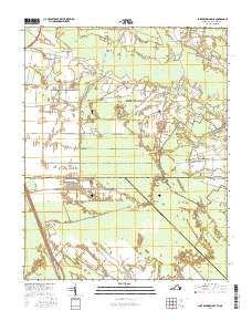
2016 Map of Lake Drummond SE
USGS Topo · Published 2016About this map
Great Dismal Swamp dominates the landscape of this 2016 survey, a massive wetland wilderness straddling the border of Virginia and North Carolina. The map captures a complex system of hydraulic engineering designed to navigate and manage this environment, including the historic Dismal Swamp Canal and the Intracoastal Waterway. A network of numbered drainage channels, such as Number One Ditch through Number Four Ditch, crisscrosses the terrain, illustrating the long-term efforts to reclaim and utilize this saturated land.
Find a feature on this map
44 named features on this map. Tap any name to fly to it.
Don’t see what you’re looking for? This feature index may not catch every label — zoom into the map to look around manually.
Map Details
Editions of this 2016 Lake Drummond SE Map
This is the sole edition of this map. No revisions or reprints were ever made.
Other maps of this area

1939 · Moyock
USGS Topo · 1:62,500

1940 · Lake Drummond
USGS Topo · 1:62,500

1940 · South Mills
USGS Topo · 1:62,500

1945 · Lake Drummond
USGS Topo · 1:62,500

1946 · Moyock
USGS Topo · 1:62,500

1948 · Elizabeth City
USGS Topo · 1:62,500

1952 · South Mills
USGS Topo · 1:62,500

1953 · Norfolk
USGS Topo · 1:250,000
1954 · Fentress
USGS Topo · 1:24,000
1954 · Lake Drummond NW
USGS Topo · 1:24,000