2022 Map of Lake Forest
USGS Topo · Published 2022About this map
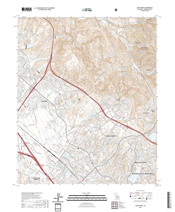
Lake Forest and the surrounding South Orange County communities are defined by the dense residential expansion extending toward the foothills of the Cleveland National Forest. This modern survey reveals the suburban conversion of the landscape, where the historical heart of El Toro is surrounded by newer planned developments like Foothill Ranch, Portola Hills, and the edges of Mission Viejo and Irvine. The map preserves the geography of the era's major transportation arteries, such as the Foothill Transportation Corridor and El Toro Rd, which bridge the gap between the urban flats and the canyon country.
Find a feature on this map
53 named features on this map. Tap any name to fly to it.
Don’t see what you’re looking for? This feature index may not catch every label — zoom into the map to look around manually.
Map Details
Editions of this 2022 Lake Forest Map
This is the sole edition of this map. No revisions or reprints were ever made.
Historical Maps of Altair Through Time
1 maps found