2024 Map of Lake Harbor
USGS Topo · Published 2024About this map
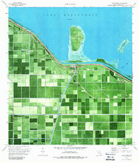
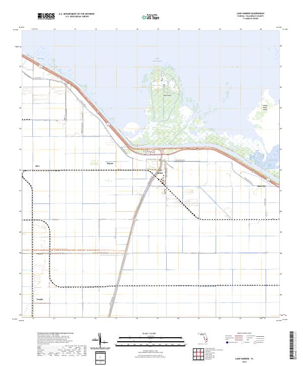
Lake Harbor sits at the southern terminus of the Miami Canal where it meets the vast expanse of Lake Okeechobee. This agricultural landscape is defined by its rigorous drainage grid and the massive dike system of the Rim Canal, which separates the fertile muck lands from the open waters and marshes of the lake. Small settlements and place names like Bean City, Watson, and Mott are clustered along the historical transportation corridor of Old US Hwy 27, reflecting the region's deep ties to sugar and vegetable farming. Notable landmarks include Ritta Island and Halifax Banks Island rising from the lake's shallows, and the Florida National Scenic Trail, which traces the embankment above the water. Cultural indicators such as Mutt Thomas Quarters and various farm roads show the organized labor and residential patterns essential to the area's specialized economy.
Find a feature on this map
26 named features on this map. Tap any name to fly to it.
Don’t see what you’re looking for? This feature index may not catch every label — zoom into the map to look around manually.
Map Details
Editions of this 2024 Lake Harbor Map
This is the sole edition of this map. No revisions or reprints were ever made.