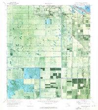
1970 Map of Lake Harbor
USGS Topo · Published 1988About this map
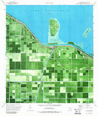
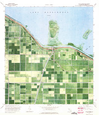
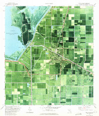
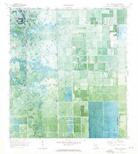
The agricultural landscape of the Everglades rim is captured here through an orthophotomap, where the geometric precision of sugar cane fields and drainage canals meets the southern edge of Lake Okeechobee. The settlement of Lake Harbor serves as a central hub where the Seaboard Coast Line and Florida East Coast railroads intersect. This rail infrastructure was critical for moving local produce from areas like Bean City and Little Bare Beach to northern markets.
Find a feature on this map
17 named features on this map. Tap any name to fly to it.
Don’t see what you’re looking for? This feature index may not catch every label — zoom into the map to look around manually.
Map Details
Editions of this 1970 Lake Harbor Map
2 editions found
Other maps of this area

1956 · West Palm Beach
USGS Topo · 1:250,000

1957 · West Palm Beach
USGS Topo · 1:250,000

1958 · West Palm Beach
USGS Topo · 1:250,000
1970 · Lake Harbor
USGS Topo · 1:24,000
1970 · Belle Glade
USGS Topo · 1:24,000

1970 · Lake Harbor SE
USGS Topo · 1:24,000
1970 · Lake Harbor SW
USGS Topo · 1:24,000
1970 · Clewiston South
USGS Topo · 1:24,000

1970 · Okeelanta
USGS Topo · 1:24,000
1970 · Pahokee
USGS Topo · 1:24,000