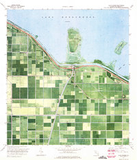
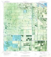
1970 Map of Lake Harbor
USGS Topo · Published 1971About this map
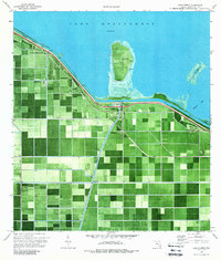
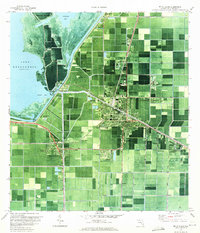
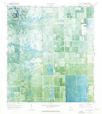
Lake Harbor and the southern shores of Lake Okeechobee are defined by a precision-engineered landscape of drainage and transport at the dawn of the 1970s. This orthophotomosaic reveals the intense agricultural grid of the Everglades, protected by the Herbert Hoover Dyke and the Rim Canal. Small settlements like Bean City and Little Bare Beach sit along the embankment, while the interior is partitioned by the Florida East Coast and Seaboard Coast Line railroads.
Find a feature on this map
17 named features on this map. Tap any name to fly to it.
Don’t see what you’re looking for? This feature index may not catch every label — zoom into the map to look around manually.
Map Details
Editions of this 1970 Lake Harbor Map
2 editions found
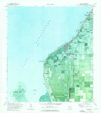
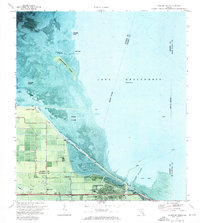
Other maps of this area

1956 · West Palm Beach
USGS Topo · 1:250,000

1957 · West Palm Beach
USGS Topo · 1:250,000

1958 · West Palm Beach
USGS Topo · 1:250,000
1970 · Belle Glade
USGS Topo · 1:24,000

1970 · Lake Harbor SE
USGS Topo · 1:24,000
1970 · Lake Harbor SW
USGS Topo · 1:24,000
1970 · Clewiston South
USGS Topo · 1:24,000

1970 · Okeelanta
USGS Topo · 1:24,000
1970 · Pahokee
USGS Topo · 1:24,000
1971 · Clewiston North
USGS Topo · 1:24,000