
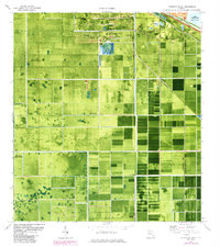
1970 Map of Clewiston South
USGS Topo · Published 1976About this map
Clewiston sits at the northern edge of this orthophotomap, anchoring a landscape heavily defined by industrial agriculture and water management on the southern shores of Lake Okeechobee. The 1970 aerial photography reveals the geometric precision of the Everglades' reclamation, with the Herbert Hoover Dike and Rim Canal forming a hard boundary against the lake while the L-1 Canal and numerous pump stations regulate the surrounding fields. The infrastructure of the sugar industry is prominent at Sugar Junction, supported by the Seaboard Coast Line railroad which cuts diagonally across the terrain.
Find a feature on this map
24 named features on this map. Tap any name to fly to it.
Don’t see what you’re looking for? This feature index may not catch every label — zoom into the map to look around manually.
Map Details
Editions of this 1970 Clewiston South Map
2 editions found
Other maps of this area

1956 · West Palm Beach
USGS Topo · 1:250,000

1957 · West Palm Beach
USGS Topo · 1:250,000

1958 · West Palm Beach
USGS Topo · 1:250,000

1970 · Lake Harbor
USGS Topo · 1:24,000

1970 · Lake Harbor SE
USGS Topo · 1:24,000

1970 · Moore Haven
USGS Topo · 1:24,000

1970 · Lake Harbor SW
USGS Topo · 1:24,000

1970 · La Belle 4 SE
USGS Topo · 1:24,000

1970 · La Belle 4 NE
USGS Topo · 1:24,000
1971 · Clewiston North
USGS Topo · 1:24,000