
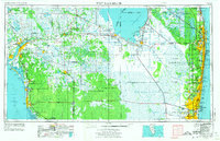
1956 Map of West Palm Beach
USGS Topo · Published 1964About this map
The Everglades and Big Cypress Swamp dominate the Southern Florida interior, revealing a mid-century landscape defined by massive water management projects and scattered agricultural settlements. Along the southern rim of Lake Okeechobee, communities like Pahokee, Belle Glade, and the small settlement of Chosen are linked by a complex network of drainage works including the Miami Canal, Hillsboro Canal, and Bolles Canal. These engineering feats allowed for the expansion of inland towns like Immokalee and Clewiston into once-impenetrable wetlands.
Find a feature on this map
115 named features on this map. Tap any name to fly to it.
Don’t see what you’re looking for? This feature index may not catch every label — zoom into the map to look around manually.
Map Details
Editions of this 1956 West Palm Beach Map
2 editions found
Other maps of this area

1945 · Fort Lauderdale North
USGS Topo · 1:24,000

1945 · Delta
USGS Topo · 1:24,000

1945 · Greenacres City
USGS Topo · 1:24,000

1945 · Lake Worth
USGS Topo · 1:24,000

1946 · Riviera Beach
USGS Topo · 1:24,000

1946 · West Dixie Bend
USGS Topo · 1:24,000

1946 · Boca Raton
USGS Topo · 1:24,000

1946 · Palm Beach Farms
USGS Topo · 1:24,000

1946 · Palm Beach
USGS Topo · 1:24,000

1947 · North Miami
USGS Topo · 1:24,000