2023 Map of Lake Odessa
USGS Topo · Published 2023About this map
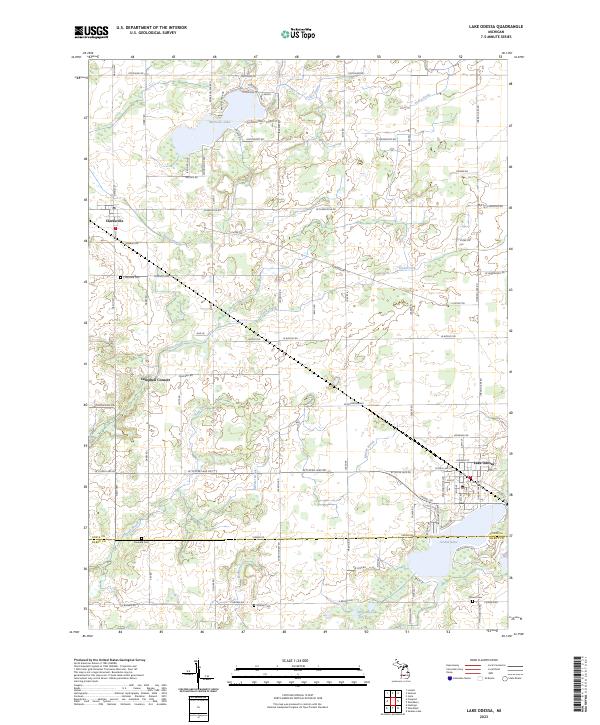
Lake Odessa and its waterfront along Jordan Lake anchor this topographical study of the borderlands between Ionia and Barry Counties. The village is characterized by a dense grid of residential streets like Emerson St and Laurel Dr, giving way to the sprawling recreational developments of Dausman Park and Sunset Beach at Morrison Lake further north. Agricultural patterns dominate the center of the quadrangle, with the small settlement of Clarksville serving as a local hub for the surrounding farmstead network. A complex system of waterways, including Duck Creek and Messer Brook, flows through the lowlands, reflecting the region's glacial legacy and drainage history. Local genealogy is supported by the presence of several established burial grounds, such as Dunkard Cem and Mauch Cem, which mark the resting places of earlier generations who settled along corridors like Clinton Trl.
Find a feature on this map
89 named features on this map. Tap any name to fly to it.
Don’t see what you’re looking for? This feature index may not catch every label — zoom into the map to look around manually.
Map Details
Editions of this 2023 Lake Odessa Map
This is the sole edition of this map. No revisions or reprints were ever made.
Historical Maps of Campbell Township Through Time

Featured Locations
- Berlin Township, MI
- Odessa Township, MI
- Woodland Township, MI
- Clarksville, Campbell Township
- Lake Odessa, Odessa Township