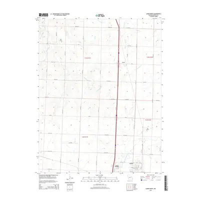
2015 Map of Lamar North
USGS Topo · Published 2015About this map
Lamar and its northern outskirts are captured in this detail-oriented 2015 study, showcasing the transition from the city center to the rural expanses of Barton County. The landscape is defined by the North Fork Spring River in the south, while the northern sections are carved by numerous tributaries including Little Dry Wood Creek and Pleasant Run Cr. Family-history researchers will find interest in the documented locations of Bakers Grove Cemetery and Nigh Cemetery, which serve as quiet landmarks among the township and range lines. The settlement patterns follow a rigid grid of county roads, such as NW 80th RD and Ne 20th RD, connecting the small communities of Irwin and Lamar Heights. This modern topographic perspective reveals a region where the traditional agriculture-based layout remains remarkably intact, despite the primary transit corridor cutting through the center of the quadrangle.
Find a feature on this map
61 named features on this map. Tap any name to fly to it.
Don’t see what you’re looking for? This feature index may not catch every label — zoom into the map to look around manually.
Map Details
Editions of this 2015 Lamar North Map
This is the sole edition of this map. No revisions or reprints were ever made.
Other maps of this area

1886 · Nevada
USGS Topo · 1:125,000

1886 · Carthage
USGS Topo · 1:125,000

1894 · Nevada
USGS Topo · 1:125,000

1894 · Carthage
USGS Topo · 1:125,000

1947 · Joplin
USGS Topo · 1:250,000

1949 · Joplin
USGS Topo · 1:250,000

1954 · Joplin
USGS Topo · 1:250,000

1958 · Joplin
USGS Topo · 1:250,000

1959 · Joplin
USGS Topo · 1:250,000
1962 · Kenoma
USGS Topo · 1:24,000