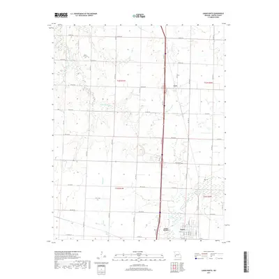
2017 Map of Lamar North
USGS Topo · Published 2017About this map
Lamar and its northern outskirts are the central focus of this 2017 survey of Barton County, Missouri. The landscape is defined by an intricate network of waterways, including Little Dry Wood Creek, Dicks Fork, and the North Fork Spring River, which drain the agricultural prairie. Small rural clusters like Irwin and Lamar Heights sit along the primary north-south transportation corridor, while the surrounding countryside is partitioned by a strictly rectangular grid of county roads such as NW 80th Rd and W State Hwy V. Genealogists will find historical markers in the landscape, including Bakers Grove Cem and Nigh Cem, which are located near the headwaters of several local branches like Elm Br and Brush Run Cr. The map illustrates the transition from the city's residential streets, such as E 6th St, into the open farmland and creek bottoms that characterize this portion of Southwest Missouri.
Find a feature on this map
38 named features on this map. Tap any name to fly to it.
Don’t see what you’re looking for? This feature index may not catch every label — zoom into the map to look around manually.
Map Details
Editions of this 2017 Lamar North Map
This is the sole edition of this map. No revisions or reprints were ever made.
Other maps of this area

1886 · Nevada
USGS Topo · 1:125,000

1886 · Carthage
USGS Topo · 1:125,000

1894 · Nevada
USGS Topo · 1:125,000

1894 · Carthage
USGS Topo · 1:125,000

1947 · Joplin
USGS Topo · 1:250,000

1949 · Joplin
USGS Topo · 1:250,000

1954 · Joplin
USGS Topo · 1:250,000

1958 · Joplin
USGS Topo · 1:250,000

1959 · Joplin
USGS Topo · 1:250,000
1962 · Kenoma
USGS Topo · 1:24,000