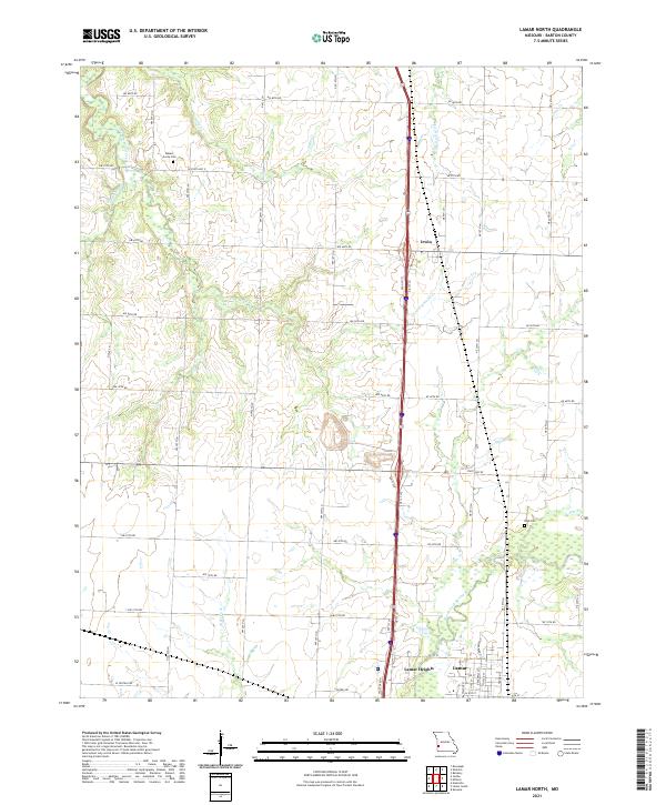
2021 Map of Lamar North
USGS Topo · Published 2021About this map
Lamar and its northern outskirts are the focal point of this Barton County landscape, where the prairie begins to break into the drainage basins of the North Fork Spring River. The transition from the structured residential grid of the city to the expansive agricultural sections of the north is marked by Lamar Heights and the small settlement of Irwin, situated along the primary north-south transit corridor. Family history and local heritage are anchored by long-standing rural landmarks such as Bakers Grove Cem in the northwest and Nigh Cem to the east. The terrain is defined by a dense network of small waterways including Little Dry Wood Creek, Dicks Fork, and Little Clear Cr, which carved the gentle draws that have historically dictated the placement of homesteads and section roads across this part of Missouri.
Find a feature on this map
35 named features on this map. Tap any name to fly to it.
Don’t see what you’re looking for? This feature index may not catch every label — zoom into the map to look around manually.
Map Details
Editions of this 2021 Lamar North Map
This is the sole edition of this map. No revisions or reprints were ever made.
Other maps of this area

1886 · Nevada
USGS Topo · 1:125,000

1886 · Carthage
USGS Topo · 1:125,000

1894 · Nevada
USGS Topo · 1:125,000

1894 · Carthage
USGS Topo · 1:125,000

1947 · Joplin
USGS Topo · 1:250,000

1949 · Joplin
USGS Topo · 1:250,000

1954 · Joplin
USGS Topo · 1:250,000

1958 · Joplin
USGS Topo · 1:250,000

1959 · Joplin
USGS Topo · 1:250,000
1962 · Kenoma
USGS Topo · 1:24,000