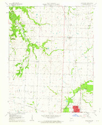
1962 Map of Lamar North
USGS Topo · Published 1963About this map
Lamar and its surrounding townships in Barton County reflect a mid-century landscape defined by agricultural plots and a dual-railroad economy. The city serves as the primary hub, showing concentrated development including the Hospital, Armory, and multiple educational buildings. The Missouri Pacific and St Louis San Francisco lines intersect the region, driving the growth of smaller settlements like Irwin and Lamar Heights.
Find a feature on this map
32 named features on this map. Tap any name to fly to it.
Don’t see what you’re looking for? This feature index may not catch every label — zoom into the map to look around manually.
Map Details
Editions of this 1962 Lamar North Map
This is the sole edition of this map. No revisions or reprints were ever made.
Other maps of this area

1886 · Nevada
USGS Topo · 1:125,000

1886 · Carthage
USGS Topo · 1:125,000

1894 · Nevada
USGS Topo · 1:125,000

1894 · Carthage
USGS Topo · 1:125,000

1947 · Joplin
USGS Topo · 1:250,000

1949 · Joplin
USGS Topo · 1:250,000

1954 · Joplin
USGS Topo · 1:250,000

1958 · Joplin
USGS Topo · 1:250,000

1959 · Joplin
USGS Topo · 1:250,000
1962 · Kenoma
USGS Topo · 1:24,000