
2011 Map of Lamar South
USGS Topo · Published 2011About this map
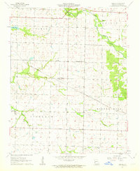
The North Fork Spring River flows through this Missouri landscape, anchoring a region defined by agricultural grids and small rural communities. The town of Lamar occupies the northeastern corner, characterized by its structured street plan and proximity to Lamar City Lake. To the south and west, the terrain becomes more agrarian, dotted with smaller settlements like Oakton, Boston, and Esrom. The latter is of particular interest to genealogists and local historians for the documented Esrom Post Office, a remnant of the early postal network that once served these outlying farming families.
Find a feature on this map
58 named features on this map. Tap any name to fly to it.
Don’t see what you’re looking for? This feature index may not catch every label — zoom into the map to look around manually.
Map Details
Editions of this 2011 Lamar South Map
This is the sole edition of this map. No revisions or reprints were ever made.
Other maps of this area

1886 · Nevada
USGS Topo · 1:125,000

1886 · Carthage
USGS Topo · 1:125,000

1894 · Nevada
USGS Topo · 1:125,000

1894 · Carthage
USGS Topo · 1:125,000

1947 · Joplin
USGS Topo · 1:250,000

1949 · Joplin
USGS Topo · 1:250,000

1954 · Joplin
USGS Topo · 1:250,000

1958 · Joplin
USGS Topo · 1:250,000

1959 · Joplin
USGS Topo · 1:250,000
1962 · Kenoma
USGS Topo · 1:24,000