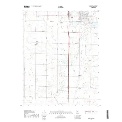
2017 Map of Lamar South
USGS Topo · Published 2017About this map
Lamar and Lamar Heights anchor the northern landscape of Barton County, where the transition from residential grid to rural agricultural land is clearly defined. The terrain is marked by the winding paths of the North Fork Spring River and its tributaries, including the W Fork River and West Fork River. Historically significant sites for genealogists include several well-placed burial grounds such as Oak Grove Cem, Killey Cem, and Saint Marys Cem. Smaller settlements like Oakton and Boston appear as modest rural centers amidst a network of section roads. The map captures the infrastructure of the early 21st century, featuring both the Lamar Municipal Airport and Twin Oaks Airport, alongside water features like Lawless Lake and Lamar City Lake, which serve as local landmarks in this Southwestern Missouri prairie region.
Find a feature on this map
63 named features on this map. Tap any name to fly to it.
Don’t see what you’re looking for? This feature index may not catch every label — zoom into the map to look around manually.
Map Details
Editions of this 2017 Lamar South Map
This is the sole edition of this map. No revisions or reprints were ever made.
Other maps of this area

1886 · Nevada
USGS Topo · 1:125,000

1886 · Carthage
USGS Topo · 1:125,000

1894 · Nevada
USGS Topo · 1:125,000

1894 · Carthage
USGS Topo · 1:125,000

1947 · Joplin
USGS Topo · 1:250,000

1949 · Joplin
USGS Topo · 1:250,000

1954 · Joplin
USGS Topo · 1:250,000

1958 · Joplin
USGS Topo · 1:250,000

1959 · Joplin
USGS Topo · 1:250,000
1962 · Kenoma
USGS Topo · 1:24,000