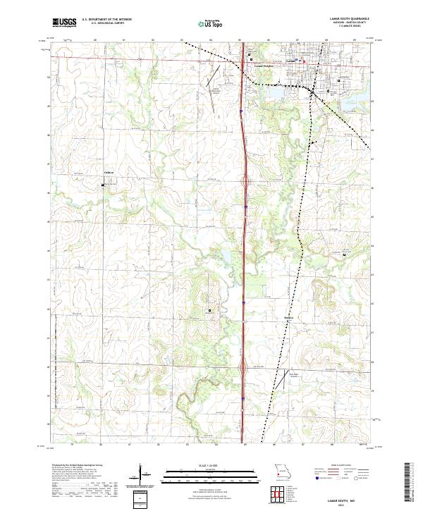
2021 Map of Lamar South
USGS Topo · Published 2021About this map
The Barton County Courthouse stands as the central landmark of Lamar, Missouri, overlooking a landscape defined by the drainage of the North Fork Spring River. To the west, the smaller settlement of Oakton is anchored by Oak Grove Cem, while to the east, the waters of Lamar City Lake provide a notable geographic break from the surrounding agricultural grid. The area around Boston and Lamar Heights reveals a dense concentration of local history markers, including several family and community burial grounds such as Killey Cem and Forest Grove Cem. The local transportation and infrastructure network is well-documented, featuring both the Lamar Municipal Airport and the smaller Twin Oaks Airport, alongside numerous rural routes like S State Hwy J and S State Hwy KK that connect the isolated farmsteads and creek crossings across the Barton County plains.
Find a feature on this map
91 named features on this map. Tap any name to fly to it.
Don’t see what you’re looking for? This feature index may not catch every label — zoom into the map to look around manually.
Map Details
Editions of this 2021 Lamar South Map
This is the sole edition of this map. No revisions or reprints were ever made.
Other maps of this area

1886 · Nevada
USGS Topo · 1:125,000

1886 · Carthage
USGS Topo · 1:125,000

1894 · Nevada
USGS Topo · 1:125,000

1894 · Carthage
USGS Topo · 1:125,000

1947 · Joplin
USGS Topo · 1:250,000

1949 · Joplin
USGS Topo · 1:250,000

1954 · Joplin
USGS Topo · 1:250,000

1958 · Joplin
USGS Topo · 1:250,000

1959 · Joplin
USGS Topo · 1:250,000
1962 · Kenoma
USGS Topo · 1:24,000